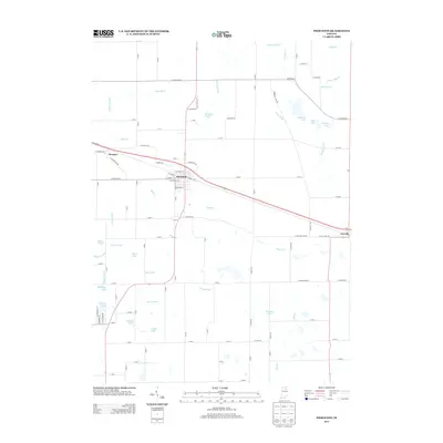
2013 Map of Pierceton
USGS Topo · Published 2013About this map
Pierceton serves as the central hub of this landscape, where the local street grid intersects with significant transportation corridors like E Market St and W Tower St. The surrounding countryside in Kosciusko County is defined by an extensive network of drainage infrastructure, including Leedy Ditch, Shanton Ditch, and Mathias Ditch, which support the agricultural productivity of the region.
Find a feature on this map
107 named features on this map. Tap any name to fly to it.
Don’t see what you’re looking for? This feature index may not catch every label — zoom into the map to look around manually.
Map Details
Editions of this 2013 Pierceton Map
This is the sole edition of this map. No revisions or reprints were ever made.
Other maps of this area

1950 · Leesburg
USGS Topo · 1:24,000

1950 · Pierceton
USGS Topo · 1:24,000

1950 · North Webster
USGS Topo · 1:24,000

1951 · Ormas
USGS Topo · 1:24,000

1953 · Fort Wayne
USGS Topo · 1:250,000

1956 · Fort Wayne
USGS Topo · 1:250,000

1956 · Lorane
USGS Topo · 1:24,000

1957 · Warsaw
USGS Topo · 1:24,000
1962 · North Manchester North
USGS Topo · 1:24,000
1962 · South Whitley West
USGS Topo · 1:24,000