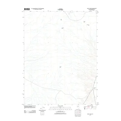
2011 Map of Pilot Cone
USGS Topo · Published 2011About this map
Deadhorse Wells serves as a primary point of interest in this arid landscape on the border of Nevada’s Mineral and Nye counties. The terrain is defined by a series of prominent rises including the Rawhide Hills and the central Koegel Hills, which suggest the volcanic and tectonic history of the region. Distinctive landmarks such as Pilot Cone and Basalt Peak dominate the skyline, providing essential navigational reference points for this high-desert environment. The mapping reveals a network of ephemeral drainage patterns flowing from Gundaker Hill and surrounding ridges, highlighting the complex natural hydrology of the Great Basin. This 2011 survey illustrates the modern road infrastructure crossing the desert, including state route 839, juxtaposed against these enduring geological features.
Find a feature on this map
9 named features on this map. Tap any name to fly to it.
Don’t see what you’re looking for? This feature index may not catch every label — zoom into the map to look around manually.
Map Details
Editions of this 2011 Pilot Cone Map
This is the sole edition of this map. No revisions or reprints were ever made.
Other maps of this area

1908 · Carson Sink
USGS Topo · 1:250,000

1909 · Hawthorne
USGS Topo · 1:250,000

1910 · Carson Sink
USGS Topo · 1:250,000

1911 · Hawthorne
USGS Topo · 1:250,000

1915 · Hawthorne
USGS Topo · 1:250,000

1948 · Walker Lake
USGS Topo · 1:250,000

1951 · Allen Springs
USGS Topo · 1:62,500

1957 · Walker Lake
USGS Topo · 1:250,000

1957 · Reno
USGS Topo · 1:250,000

1959 · Reno
USGS Topo · 1:250,000