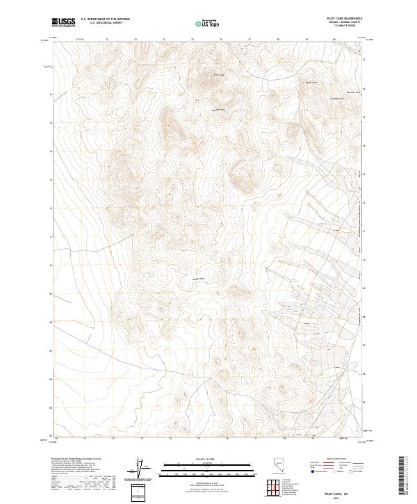
2021 Map of Pilot Cone
USGS Topo · Published 2021About this map
Pilot Cone stands as a prominent topographical landmark in this arid portion of Mineral County, anchoring a landscape defined by volcanic landforms and scattered uplands. The terrain is characterized by the Rawhide Hills to the north and the Koegel Hills in the southern reaches, illustrating the typical basin and range structure of the Great Basin. The presence of Basalt Peak and Gundaker Hill suggests a complex geological history of basaltic flows and erosion that shaped these high-elevation features. This area is heavily defined by the Public Land Survey System, with numerous township and range divisions such as t13n r31.5e and t13n r32e marking the grid. These administrative boundaries reflect the systematic mapping and management of public lands in Nevada, where the sparse network of 4WD tracks and local roads provides the only access through the desert terrain.
Find a feature on this map
11 named features on this map. Tap any name to fly to it.
Don’t see what you’re looking for? This feature index may not catch every label — zoom into the map to look around manually.
Map Details
Editions of this 2021 Pilot Cone Map
This is the sole edition of this map. No revisions or reprints were ever made.
Other maps of this area

1908 · Carson Sink
USGS Topo · 1:250,000

1909 · Hawthorne
USGS Topo · 1:250,000

1910 · Carson Sink
USGS Topo · 1:250,000

1911 · Hawthorne
USGS Topo · 1:250,000

1915 · Hawthorne
USGS Topo · 1:250,000

1948 · Walker Lake
USGS Topo · 1:250,000

1951 · Allen Springs
USGS Topo · 1:62,500

1957 · Walker Lake
USGS Topo · 1:250,000

1957 · Reno
USGS Topo · 1:250,000

1959 · Reno
USGS Topo · 1:250,000