2022 Map of Pilsen
USGS Topo · Published 2022About this map
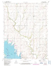
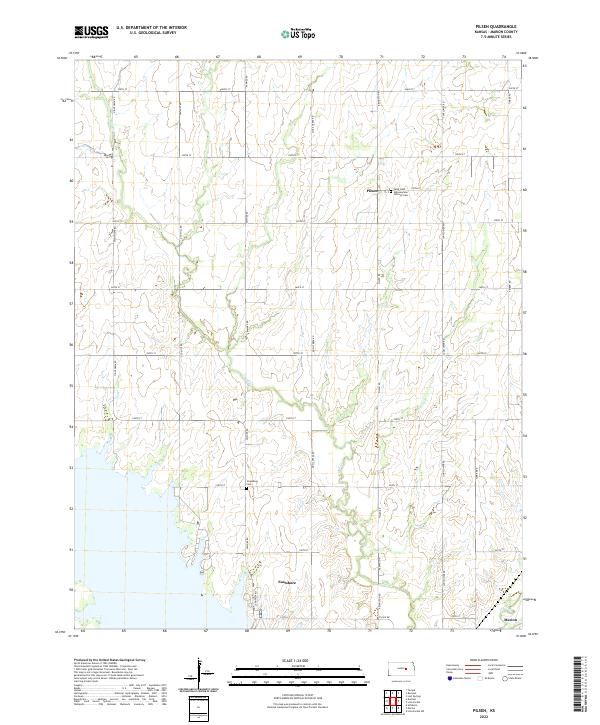
Saint John Nepomucene Catholic Cem and the small community of Pilsen stand as central landmarks in this portion of Marion County. The landscape is defined by the section-line road grid, including routes like Old Mill Rd and Pawnee RD, which navigate the gentle drainage basins of Mud Cr and Clear Cr. In the southern reaches of the quadrangle, the newer residential development of Eastshore appears near the water's edge, contrasting with the older rural character of the northern townships.
Find a feature on this map
69 named features on this map. Tap any name to fly to it.
Don’t see what you’re looking for? This feature index may not catch every label — zoom into the map to look around manually.
Map Details
Editions of this 2022 Pilsen Map
This is the sole edition of this map. No revisions or reprints were ever made.