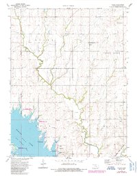
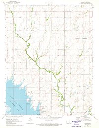
1971 Map of Pilsen
USGS Topo · Published 1985About this map
Marion Lake dominates the southwestern quadrant of this landscape, its waters controlled by the Marion Dam and feeding the North Cottonwood River. The development of recreation and wildlife areas is evident through the designated Marion Lake State Wildlife Area and Marion Lake National Hunting Area, while the shoreline community of Eastshore and the Cottonwood Point public use area highlight the mid-century transition to lakefront living. Further inland, the small settlements of Pilsen and Strassburg maintain the rural character of Marion County, connected by an evolving road network and the Oklahoma Kansas and Texas rail corridor. For genealogists, the Strassburg Cem and local Ch labels provide concrete anchors for local family histories. The presence of numerous Oil Wells scattered across the eastern sections underscores the persistent role of petroleum extraction in the regional economy during this era.
Find a feature on this map
24 named features on this map. Tap any name to fly to it.
Don’t see what you’re looking for? This feature index may not catch every label — zoom into the map to look around manually.
Map Details
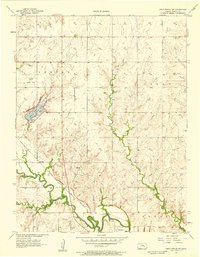
Editions of this 1971 Pilsen Map
2 editions found
Other maps of this area

1889 · Newton
USGS Topo · 1:125,000

1889 · Abilene
USGS Topo · 1:125,000

1889 · Parkerville
USGS Topo · 1:125,000

1894 · Newton
USGS Topo · 1:125,000

1894 · Abilene
USGS Topo · 1:125,000

1894 · Parkerville
USGS Topo · 1:125,000

1898 · Cottonwood Falls
USGS Topo · 1:125,000

1955 · Hutchinson
USGS Topo · 1:250,000
1957 · Lincolnville SW
USGS Topo · 1:24,000

1959 · Hutchinson
USGS Topo · 1:250,000