Old Maps of Marion County, Kansas
Explore 166 old maps of Marion County, spanning from 1889 to today. These high-resolution historic maps reveal how streets, neighborhoods, landmarks, and natural features evolved over time — perfect for genealogy, metal detecting, research, and local history exploration.
What you can do with these maps:
- See how Marion County changed over time: Compare historical maps to modern-day views to trace roads, homesites, rail lines & more.
- View detailed metadata: Each map includes creators, publishers, year, scale, and archive source.
- Overlay maps with satellite & LiDAR: Visualize the past alongside modern tools to explore terrain & human change.
- Trusted historical sources: Maps sourced from the USGS, Library of Congress, and other archives.
- Access maps your way: View online, download high-res files, or order prints for personal or research use.
Start exploring old maps of Marion County to uncover forgotten places, hidden landmarks, and the deep history beneath your feet.
Marion County, KS maps
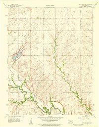
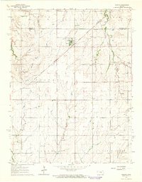
(166)- 1889 Map of Newton
 1889 Newton1889 Print · USGSRailroad expansion defines this Kansas landscape in the late 1880s, centered on the growing hubs of Newton and Marion. Genealogists and historians can trace the early grids of towns like Peabody, Hillsboro, and Lehigh as they appeared at their founding.
 - 1889 Map of Abilene
 1889 Abilene1889 Print · USGSAbilene and Dickinson County appear here in the late 1880s during the height of the Kansas railroad expansion. Genealogists and historians can trace the early development of Enterprise, Gypsum City, and Navarre along the complex network of the Union Pacific Railroad and competing lines.
 - 1889 Map of Parkerville
 1889 Parkerville1889 Print · USGSMorris and Marion County townships appear here during the great western rail boom. Genealogists and historians can trace the early layouts of Parkerville, White City, and Herrington along the Chicago Kansas and Nebraska Railroad.
 - 1894 Map of Newton
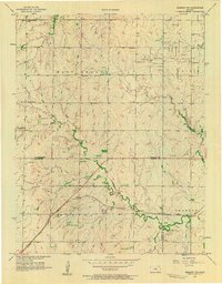
 1894 Newton1894 Print · USGSCentral Kansas was undergoing a rapid transformation into a rail-driven agricultural hub during the 1890s. Genealogists and historians can trace the early growth of Newton, Marion, and Peabody alongside branching rail lines and the winding COTTONWOOD RIVER.5 unique versions available
 - 1894 Map of Abilene
 1894 Abilene1894 Print · USGSCentral Kansas at the peak of the railroad era shows a landscape transformed by competing iron rails and river commerce. Genealogists and historians can trace family roots through early settlements like Abilene, Enterprise, and Hope, or locate old stops along the Missouri Pacific Railroad.6 unique versions available
 - 1894 Map of Parkerville
 1894 Parkerville1894 Print · USGSEastern Kansas at the height of the steam era shows a landscape transformed by competing rail lines and growing prairie towns. Genealogists and historians can trace early settlements like White City, Parkerville, and the riverside hub of Council Grove.6 unique versions available
 - 1898 Map of Cottonwood Falls
 1898 Cottonwood Falls1898 Print · USGSChase and Marion counties thrive in the late 1890s as the railroad and river valleys define the region's development. Researchers can trace the early rail paths of the Atchison Topeka and Santa Fe RR and locate settlements like Cottonwood Falls, Cedar Point, and Wonsevu.4 unique versions available
 - 1955 Map of Hutchinson, 1967 Print
 1955 Hutchinson1967 Print · USGSCentral Kansas in the mid-sixties reveals a landscape of growing reservoirs and evolving transportation corridors. Trace the development of towns like Hutchinson and Abilene alongside the Union Pacific Railroad and the expanding Interstate 70.3 unique versions available
 - 1957 Map of Peabody NW, 1958 Print
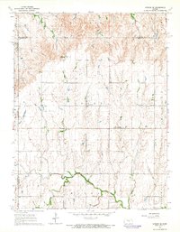
 1957 Peabody NW1958 Print · USGSMarion and Harvey County lands in the late fifties show a hardworking prairie landscape of grain and petroleum. Genealogists can trace family footprints at Doyle Valley Cem, Center Sch, and the Southwest Unger Oil Field near the Santa Fe rail line.2 unique versions available
 - 1957 Map of Florence, 1958 Print
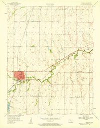
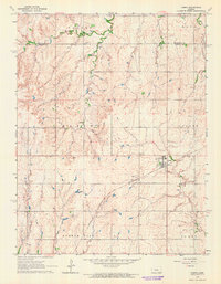
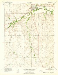 1957 Florence1958 Print · USGSMarion County in the late fifties was a bustling corridor of rail activity and prairie agriculture centered on Florence. Genealogists and researchers can trace rural life through landmarks like Summit Ch, Mt Calvary Cem, and numerous Oil Wells dotting the plains.
 - 1957 Map of Wonsevu, 1958 Print
 1957 Wonsevu1958 Print · USGSChase and Marion County farmland is captured here in the late fifties, showing the rural crossroads and creek-side settlements of the Kansas prairie. Genealogists and local historians can locate Wonsevu Cem, the Clothier Landing Field, and the winding Cedar Creek drainage.2 unique versions available
 - 1957 Map of Cedar Point, 1958 Print
 1957 Cedar Point1958 Print · USGSCedar Point and the surrounding Kansas prairie are captured here in the late fifties as the regional rail-and-river economy flourished. Researchers can trace family history through sites like Drinkwater Cem, Montgomery Cem, and the Immanuel Ch.2 unique versions available
 - 1957 Map of Lincolnville SW, 1958 Print
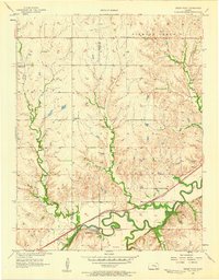
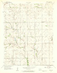
 1957 Lincolnville SW1958 Print · USGSMarion County in the late fifties shows a landscape shaped by rail and river. Genealogists can trace family roots at Grant Cem and Harter Cem, or locate the small settlement of Oursler along the Atchison Topeka and Santa Fe tracks.2 unique versions available
 - 1957 Map of Peabody, 1958 Print
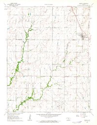
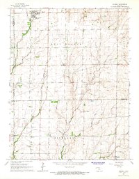
 1957 Peabody1958 Print · USGSPeabody thrived as a rail crossroads in the late 1950s, defined by the meeting of two major western railroads. Genealogists and researchers can trace the rural community through Prairie Lawn Cem, the Steinrich Ch, and the Superior Sch (Abandoned).
 - 1957 Map of Elbing, 1958 Print
 1957 Elbing1958 Print · USGSButler and Harvey Counties are documented here in the late 1950s, showing the agricultural rhythm of the Whitewater Creek basin. Genealogists and local historians can trace the foundations of the community through sites like Mission Cem, Grace Hill Ch, and the Sugar Grove Sch (Abandoned).2 unique versions available
 - 1959 Map of Hutchinson
 1959 Hutchinson1959 Print · USGSCentral Kansas thrives at the intersection of rail and river in the mid-1950s, as post-war aviation infrastructure reshapes the prairie. Genealogists and historians can trace the paths of the AT&SF RR through Newton and Hutchinson, or locate military sites like Smoky Hill Air Force Base.2 unique versions available
 - 1962 Map of Florence SE, 1963 Print
 1962 Florence SE1963 Print · USGSThe Butler and Chase County borderlands come into focus in the early sixties as a landscape of prairie drainage and agricultural sectioning. Genealogists and historians can trace the Railroad Grade and locate features like an isolated Oil Well and the Walnut River.
 - 1962 Map of Burns, 1963 Print
 1962 Burns1963 Print · USGSThe rural prairie of Marion and Butler Counties is captured here in the early sixties, centered on the community of Burns. Researchers can trace old family roots at Clifford Cem or locate the historic First Mennonite Ch and Ebenezer Ch among the local oil fields.
 - 1962 Map of Peabody SE, 1963 Print
 1962 Peabody SE1963 Print · USGSThe rural borderlands of Marion and Butler Counties are captured in the early 1960s, showing a landscape shaped by the Whitewater River and oil extraction. Genealogists can locate family landmarks like Countryside Sch, Fairplay Ch, and several pioneer cemeteries.
 - 1964 Map of Ramona, 1965 Print
 1964 Ramona1965 Print · USGSMarion and Dickinson Counties are captured in the mid-1960s, showing a landscape defined by prairie agriculture and two major rail lines. Genealogists and local historians can locate family landmarks like Rosebank Ch, Lewis Cem, and the rural community of Ramona.3 unique versions available
 - 1964 Map of Gypsum SE, 1965 Print
 1964 Gypsum SE1965 Print · USGSThis central Kansas landscape at the dawn of the sixties shows a deep-rooted rural community where the North Cottonwood River winds through fertile plains. Genealogists can trace family footprints across numerous sites like Elm Springs, the Grand Central Sch, and Friedenstal Cem.3 unique versions available
 - 1964 Map of Tampa, 1965 Print
 1964 Tampa1965 Print · USGSIn the mid-1960s, the rural community of Tampa stood as a key rail point for the surrounding grain country. Genealogists can trace family footprints across several local burial grounds like College Hill Cem and St Mary Cem near the Rock Island line.4 unique versions available
 - 1965 Map of Goessel, 1966 Print
 1965 Goessel1966 Print · USGSMarion and Harvey counties appear in the mid-1960s as a structured agricultural landscape centered on the town of Goessel. Genealogists and local historians can trace rural roots through landmarks like Highland Ch, Grange Hall, and Greenfield Cem.
 - 1970 Map of Lincolnville NE, 1972 Print
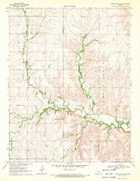 1970 Lincolnville NE1972 Print · USGSThe Flint Hills border of Marion and Chase counties is captured here in the early seventies, showing a landscape defined by deep creek valleys and open range. Researchers can trace family history at Elk Cem or locate early industrial sites like the local Quarry and Oil Well.
 - 1971 Map of Durham, 1972 Print
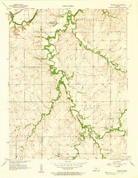
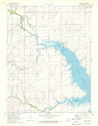 1971 Durham1972 Print · USGSDurham and the surrounding Marion County plains are shown here in the early seventies as the newly formed Marion Reservoir reshaped the landscape. Trace local family history through sites like Johannestal Cem, Suncrest Sch, and the Durham Oil and Gas Field.2 unique versions available
Showing maps 1-25 of 166
Top cities of Marion County
- Hillsboro historical maps
- Marion historical maps
- Peabody historical maps
- Florence historical maps
- Goessel historical maps
- Burns historical maps
See more
Frequently asked questions
- What are the different types of historical maps available for Marion County?
- What is the oldest map of Marion County?
- Where can I purchase historical maps of Marion County for my home or office?
- Where can I download high-res historical maps of Marion County?
- Are there historical topographic maps available for Marion County?
- Is there historical aerial imagery available for Marion County?
- Where are historical maps of Marion County sourced from?