1970s Maps of Marion County, Kansas
Explore 10 historic maps of Marion County from the 1970s. These maps offer a rare glimpse into what life looked like during the 1970s — showing old roads, neighborhoods, homes, and landmarks that have changed or disappeared over time.
Whether you're researching your family's past, planning a metal detecting trip, or studying how Marion County's landscape evolved across the 1970s, these high-resolution maps are a powerful tool for exploring the history of this region.
- Focus on a specific era: All maps on this page are from the 1970s, giving you a focused view of this time period.
- See what’s changed: Compare century-old streets, trails, and buildings to today's modern landscape using overlays and satellite layers.
- Research with precision: Use these maps for genealogy, historical research, land use analysis, or educational projects.
- View, download, or print: Maps are fully viewable online in high resolution, and can be downloaded or printed for your own records.
Start exploring Marion County's history through authentic maps from the 1970s. This is your window into the past.
Marion County, KS maps
(10)- 1970 Map of Lincolnville NE, 1972 Print
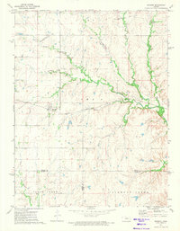
 1970 Lincolnville NE1972 Print · USGSThe Flint Hills border of Marion and Chase counties is captured here in the early seventies, showing a landscape defined by deep creek valleys and open range. Researchers can trace family history at Elk Cem or locate early industrial sites like the local Quarry and Oil Well.
 - 1971 Map of Durham, 1972 Print
 1971 Durham1972 Print · USGSDurham and the surrounding Marion County plains are shown here in the early seventies as the newly formed Marion Reservoir reshaped the landscape. Trace local family history through sites like Johannestal Cem, Suncrest Sch, and the Durham Oil and Gas Field.2 unique versions available
 - 1971 Map of Lehigh, 1972 Print
 1971 Lehigh1972 Print · USGSMarion County's Mennonite farming heartland is captured here in the early seventies, centered on the rail-side community of Lehigh. Researchers can trace local lineage through several historic sites, including the Alexanderwohl Ch and Springfield Cem.2 unique versions available
 - 1971 Map of Lincolnville, 1972 Print
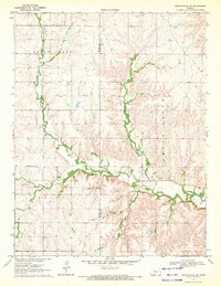
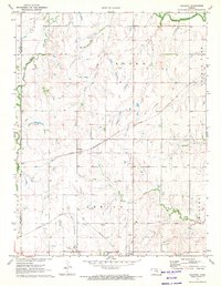
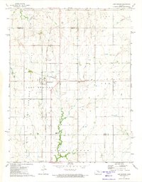
 1971 Lincolnville1972 Print · USGSMarion County's prairie landscape is captured here in the early seventies, showing a period of steady agricultural and industrial activity. Researchers can trace the CHICAGO ROCK ISLAND AND PACIFIC rail line through Lincolnville and Antelope, or locate the LOST SPRINGS GAS FIELD and local Quarry sites.
 - 1971 Map of Waldeck, 1972 Print
 1971 Waldeck1972 Print · USGSMarion County rail and river life is captured here in the early seventies, centered on the small settlements of Lehigh and Waldeck. Researchers can trace old family roots at Mennonite Cem and follow the paths of the Atchison Topeka and Santa Fe railroad.2 unique versions available
 - 1971 Map of Marion, 1973 Print
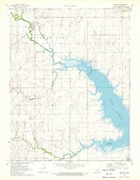
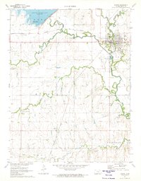 1971 Marion1973 Print · USGSThe Marion countryside in the early seventies shows a landscape shaped by the new reservoir and historic rail lines. Researchers can trace rural lineages through sites like Canada Cem, the settlement of Aulne, and Our Lady of Perpetual Help Ch.2 unique versions available
 - 1971 Map of Pilsen, 1973 Print
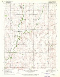
 1971 Pilsen1973 Print · USGSMarion County's rural heartland is captured here in the early seventies as new lakeside developments began to transform the prairie. Genealogists and local historians can locate the Strassburg Cem, the community of Pilsen, and the Chicago Rock Island and Pacific rail line.2 unique versions available
 - 1971 Map of Hillsboro, 1973 Print
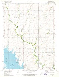
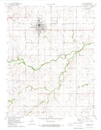 1971 Hillsboro1973 Print · USGSHillsboro and its surrounding townships are shown here during the early seventies, a period of transition as the local reservoir reshaped the northern horizon. Genealogists can trace family ties through several local landmarks like Gnadenau Cem, Parkview Cem, and the Ebenfeld School.2 unique versions available
 - 1972 Map of Burdick, 1974 Print
 1972 Burdick1974 Print · USGSBurdick and the surrounding Flint Hills borderlands are captured here during the early seventies, centered on the Atchison Topeka and Santa Fe rail corridor. Genealogists and local historians can trace family land near Hebron Church or follow the winding courses of Sixmile Creek and Diamond Creek.
 - 1972 Map of Lost Springs, 1974 Print
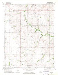
 1972 Lost Springs1974 Print · USGSLost Springs and the surrounding Marion County countryside are captured here in the early seventies at a peak of rail and resource activity. Researchers can trace the junction of the Chicago Topeka and Santa Fe and the Chicago Rock Island and Pacific railroads near Old Mission Cem and active Oil Wells.
End of results
Showing maps 1-10 of 10
Top cities of Marion County
- Hillsboro historical maps
- Marion historical maps
- Peabody historical maps
- Florence historical maps
- Goessel historical maps
- Burns historical maps
See more
Frequently asked questions
- What are the different types of historical maps available for Marion County?
- What is the oldest map of Marion County?
- Where can I purchase historical maps of Marion County for my home or office?
- Where can I download high-res historical maps of Marion County?
- Are there historical topographic maps available for Marion County?
- Is there historical aerial imagery available for Marion County?
- Where are historical maps of Marion County sourced from?