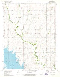
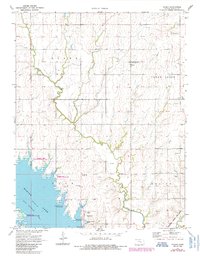
1971 Map of Pilsen
USGS Topo · Published 1973About this map
Marion Reservoir dominates the southwest corner of this landscape, its waters held back by the Marion Dam and forming the North Cottonwood River below. This early 1970s survey captures a rural Kansas transition, where traditional prairie farming near Pilsen meets the newly established recreational infrastructure of the Cottonwood Point Public Use Area and Marion Cove Public Use Area. The map reveals a land divided into distinct townships like Clark, Clear Creek, and Gale, with the community of Eastshore emerging along the reservoir's banks.
Find a feature on this map
27 named features on this map. Tap any name to fly to it.
Don’t see what you’re looking for? This feature index may not catch every label — zoom into the map to look around manually.
Map Details
Editions of this 1971 Pilsen Map
2 editions found
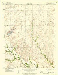
Other maps of this area

1889 · Newton
USGS Topo · 1:125,000

1889 · Abilene
USGS Topo · 1:125,000

1889 · Parkerville
USGS Topo · 1:125,000

1894 · Newton
USGS Topo · 1:125,000

1894 · Abilene
USGS Topo · 1:125,000

1894 · Parkerville
USGS Topo · 1:125,000

1898 · Cottonwood Falls
USGS Topo · 1:125,000

1955 · Hutchinson
USGS Topo · 1:250,000
1957 · Lincolnville SW
USGS Topo · 1:24,000

1959 · Hutchinson
USGS Topo · 1:250,000