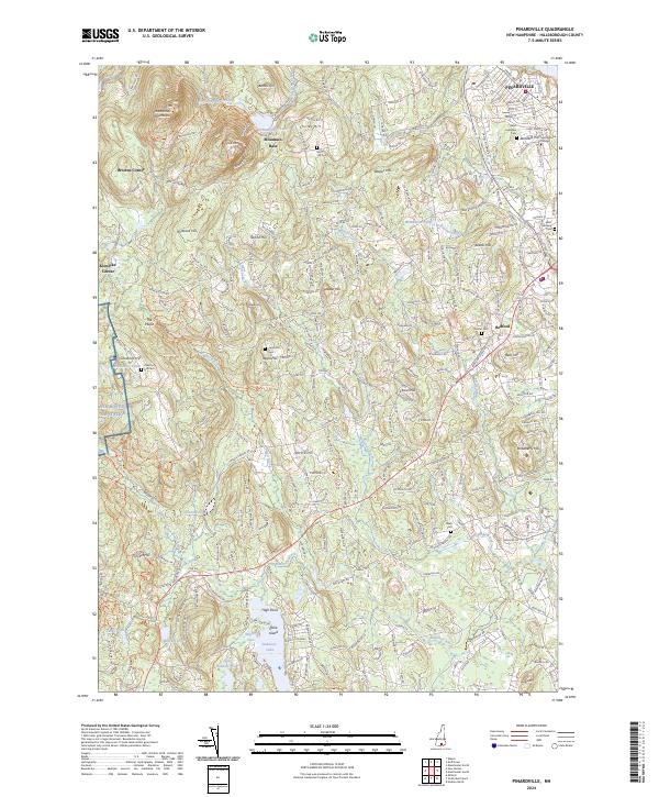
2024 Map of Pinardville
USGS Topo · Published 2024About this map
Saint Anselm College serves as a prominent landmark in the northeast corner of this Hillsborough County landscape, situated just east of the village of Pinardville. The terrain is defined by a series of significant heights, including South Mtn and North Mtn, which overlook the Uncanoonuc Lake and its associated Mountain Base settlement. To the west, the landscape transitions toward the New Boston Air Station and the geological formation known as The Pulpit. Numerous family-named landmarks and cemeteries, such as Chestnut Hill Cem and Joppa Hill Cem, are scattered throughout the region, offering clear evidence of long-standing local lineage. In the southern portion, Baboosic Lake and Little Baboosic Lake anchor a series of waterways and coves, including Washer Cove, that drain through the winding Baboosic Brook.
Find a feature on this map
64 named features on this map. Tap any name to fly to it.
Don’t see what you’re looking for? This feature index may not catch every label — zoom into the map to look around manually.
Map Details
Editions of this 2024 Pinardville Map
This is the sole edition of this map. No revisions or reprints were ever made.
Other maps of this area

1905 · Manchester
USGS Topo · 1:62,500

1906 · Milford
USGS Topo · 1:62,500

1921 · Suncook
USGS Topo · 1:62,500

1927 · Concord
USGS Topo · 1:62,500

1941 · Manchester
USGS Topo · 1:62,500

1943 · Lowell
USGS Topo · 1:125,000

1943 · Fitchburg
USGS Topo · 1:125,000

1944 · Suncook
USGS Topo · 1:62,500

1948 · Boston
USGS Topo · 1:250,000

1949 · Portland
USGS Topo · 1:250,000