
1968 Map of Pine Bluffs
USGS Topo · Published 1978About this map
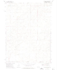
The dramatic western escarpments of Kinney Rim and Sand Butte Rim dominate this high-desert landscape in southern Wyoming. Surveyed in the late 1960s with updates through the 1970s, the map reveals a terrain defined by sharp geologic transitions and seasonal watercourses. Small springs like Jackknife Spring and Sand Butte Spring offer rare reliable water points in an area marked by extensive dry washes and draws, such as Dripping Rock Draw and Alkali Wash.
Find a feature on this map
19 named features on this map. Tap any name to fly to it.
Don’t see what you’re looking for? This feature index may not catch every label — zoom into the map to look around manually.
Map Details
Editions of this 1968 Pine Bluffs Map
This is the sole edition of this map. No revisions or reprints were ever made.
Other maps of this area

1954 · Scottsbluff
USGS Topo · 1:250,000

1954 · Cheyenne
USGS Topo · 1:250,000

1958 · Cheyenne
USGS Topo · 1:250,000

1958 · Scottsbluff
USGS Topo · 1:250,000

1963 · Pine Bluffs
USGS Topo · 1:24,000

1963 · Lindbergh
USGS Topo · 1:24,000

1963 · Pine Bluffs SE
USGS Topo · 1:24,000

1963 · Pine Bluffs SW
USGS Topo · 1:24,000

1963 · Tracy
USGS Topo · 1:24,000
1972 · Bushnell SW
USGS Topo · 1:24,000