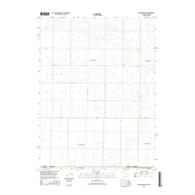
2015 Map of Pine Bluffs SW
USGS Topo · Published 2015About this map
The Pawnee National Grassland dominates the southern reaches of this landscape where the high plains of northern Weld County meet the Wyoming border. This terrain is defined by a sparse but essential network of water sources, including the drainage of Muddy Creek in the north and the centrally located Spring Creek. The presence of the Gardner Reservoir highlights the critical role of water management in this arid agricultural and grazing region. Organized by the Public Land Survey System, the area is subdivided into township and range blocks such as t13n r61w and t12n r61w, with a grid of county roads including CR-159, CR-206, and CR-203 providing the primary access across the open range. This 2015 survey illustrates the enduring rural character of the borderlands, where state lines and section boundaries dictate the layout of the modern landscape.
Find a feature on this map
20 named features on this map. Tap any name to fly to it.
Don’t see what you’re looking for? This feature index may not catch every label — zoom into the map to look around manually.
Map Details
Editions of this 2015 Pine Bluffs SW Map
This is the sole edition of this map. No revisions or reprints were ever made.
Other maps of this area

1954 · Cheyenne
USGS Topo · 1:250,000

1954 · Greeley
USGS Topo · 1:250,000

1957 · Greeley
USGS Topo · 1:250,000

1958 · Cheyenne
USGS Topo · 1:250,000

1958 · Greeley
USGS Topo · 1:250,000

1961 · Greeley
USGS Topo · 1:250,000

1963 · Pine Bluffs
USGS Topo · 1:24,000

1963 · Burns
USGS Topo · 1:24,000

1963 · Pine Bluffs SE
USGS Topo · 1:24,000

1963 · Carpenter
USGS Topo · 1:24,000