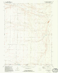
1991 Map of Pine Bluffs SW
USGS Topo · Published 1995About this map
The High Plains landscape at the border of Wyoming and Colorado is defined by its wide drainage basins and sparse ranching outposts in the early 1990s. This survey area is bisected by the Laramie County and Weld County line, marking the transition between the two states. The topography is shaped by the winding course of Muddy Creek, which flows through the northern sections, while the southern reaches are marked by intermittent water sources including Spring Creek and several unnamed springs.
Find a feature on this map
11 named features on this map. Tap any name to fly to it.
Don’t see what you’re looking for? This feature index may not catch every label — zoom into the map to look around manually.
Map Details
Editions of this 1991 Pine Bluffs SW Map
This is the sole edition of this map. No revisions or reprints were ever made.
Other maps of this area

1954 · Cheyenne
USGS Topo · 1:250,000

1954 · Greeley
USGS Topo · 1:250,000

1957 · Greeley
USGS Topo · 1:250,000

1958 · Cheyenne
USGS Topo · 1:250,000

1958 · Greeley
USGS Topo · 1:250,000

1961 · Greeley
USGS Topo · 1:250,000

1963 · Pine Bluffs
USGS Topo · 1:24,000

1963 · Burns
USGS Topo · 1:24,000

1963 · Pine Bluffs SE
USGS Topo · 1:24,000

1963 · Carpenter
USGS Topo · 1:24,000