Loading...
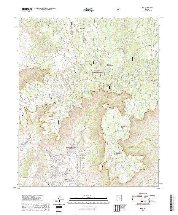
Loading map...2021 Map of Pine
USGS Topo · Published 2021About this map
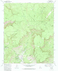
Pine serves as the central settlement on this modern survey, marking the transition from the Mogollon Plateau down the steep descent of the Mogollon Rim. The landscape is defined by the intersection of the Coconino National Forest and Tonto National Forest, characterized by deep incisions like Clover Canyon and Pivot Rock Canyon. Historically significant routes, including the General Crook Trl and the Arizona National Scenic Trl, trace the high ground and canyon rims.
Find a feature on this map
91 named features on this map. Tap any name to fly to it.
Don’t see what you’re looking for? This feature index may not catch every label — zoom into the map to look around manually.
Map Details
Date Portrayed2021
Date Published2021
PublisherU.S. Geological Survey
Map TypeTopographic
Scale1:24000
Physical Dimensions24 x 29 inches
Editions of this 2021 Pine Map
This is the sole edition of this map. No revisions or reprints were ever made.
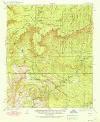
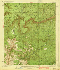
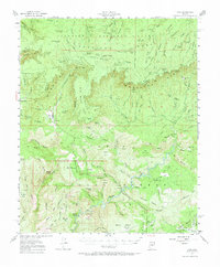
Historical Maps of Pine Through Time
5 maps found
Featured Locations
Source Details
SourceU.S. Geological Survey
CopyrightPublic Domain