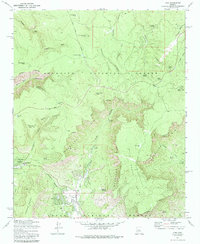
1973 Map of Pine
USGS Topo · Published 1985About this map
Pine and Strawberry anchor this study of the transition between the high plateaus and the valley below, dominated by the massive escarpment of the Mogollon Rim. This 1973 field-checked survey reveals a landscape of high-altitude camps and water management, where numerous tanks and springs like Horse Pasture Tank and Dripping Springs sustained local life. The route of the Zane Grey Highway cuts through the northern timberlands of the Coconino National Forest, while the southern reaches fall within the Tonto National Forest. Notable landmarks such as Milk Ranch Point and Baker Butte provide clear orientation points above the complex drainages of Pine Creek and Strawberry Creek. The presence of Camp Geronimo and Camp Lo Mia highlights the area's mid-century role as a recreational and educational retreat within the Mogollon Rim country.
Find a feature on this map
51 named features on this map. Tap any name to fly to it.
Don’t see what you’re looking for? This feature index may not catch every label — zoom into the map to look around manually.
Map Details
Editions of this 1973 Pine Map
3 editions found
Other maps of this area

1887 · Verde
USGS Topo · 1:250,000

1892 · Verde
USGS Topo · 1:250,000

1923 · Camp Verde
USGS Topo · 1:125,000

1929 · Turret Peak
USGS Topo · 1:125,000

1932 · Camp Verde
USGS Topo · 1:125,000

1933 · Turret Peak
USGS Topo · 1:125,000

1934 · Pine
USGS Topo · 1:62,500

1936 · Camp Verde
USGS Topo · 1:125,000

1940 · Pine
USGS Topo · 1:62,500

1952 · Pine
USGS Topo · 1:62,500