
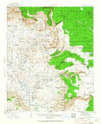
1932 Map of Camp Verde
USGS Topo · Published 1959About this map
Montezuma Castle National Monument and the prehistoric site of Montezuma Well anchor this early 1930s survey of the Verde Valley. The landscape transitions from the high plateaus of the Coconino National Forest down into the fertile bottomlands where the Verde River meets Beaver Creek. During this era, Sedona and Cornville appear as modest rural centers supported by scattered agriculture and ranching operations like the Coconino Cattle Co Ranch and Gray Ranch.
Find a feature on this map
130 named features on this map. Tap any name to fly to it.
Don’t see what you’re looking for? This feature index may not catch every label — zoom into the map to look around manually.
Map Details
Editions of this 1932 Camp Verde Map
2 editions found
Other maps of this area

1886 · San Francisco Mtns
USGS Topo · 1:250,000

1886 · Chino
USGS Topo · 1:250,000

1887 · Verde
USGS Topo · 1:250,000

1887 · Prescott
USGS Topo · 1:250,000

1891 · San Francisco Mtns
USGS Topo · 1:250,000

1891 · Chino
USGS Topo · 1:250,000

1892 · Verde
USGS Topo · 1:250,000

1892 · Prescott
USGS Topo · 1:250,000

1894 · San Francisco Mtns
USGS Topo · 1:250,000

1899 · San Francisco Mtns
USGS Topo · 1:250,000