2024 Map of Pine Island Center
USGS Topo · Published 2024About this map
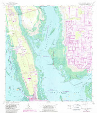
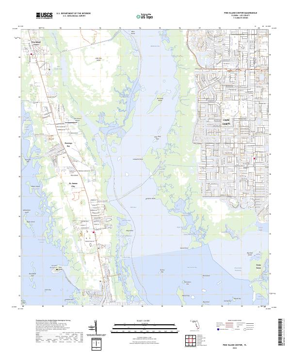
Pine Island serves as the focal point of this coastal survey, where the established fishing and residential community of St. James City anchors the southern tip. The landscape is a complex network of mangrove keys and tidal waters, protected in large part by the Matlacha Pass National Wildlife Refuge and the J N Ding Darling National Wildlife Refuge. Traces of the area's deep history are evident at the Galt Island Burial Mound, while more modern infrastructure is represented by the Woodstock Airport and the expanding residential grid of Cape Coral appearing to the east. Navigational features like the Florida Circumnavigational Paddling Trl and the Great Calusa Blueway Trail Phase III Trl highlight the region's reliance on the water, connecting points such as Punta Rassa and Flamingo Bay through the intricate channels of Matlacha Pass.
Find a feature on this map
79 named features on this map. Tap any name to fly to it.
Don’t see what you’re looking for? This feature index may not catch every label — zoom into the map to look around manually.
Map Details
Editions of this 2024 Pine Island Center Map
This is the sole edition of this map. No revisions or reprints were ever made.