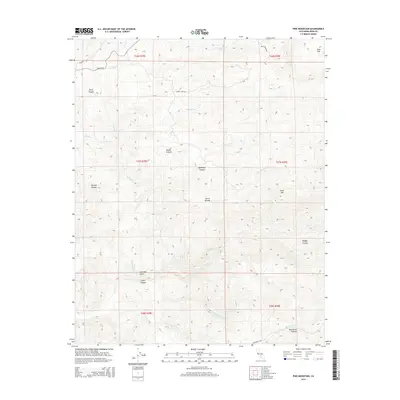
2015 Map of Pine Mountain
USGS Topo · Published 2015About this map
The Sierra Nevada foothills of Kern County are defined by a complex network of seasonal drainages and canyon systems, centered on the prominent Pine Mtn. This landscape demonstrates the essential role of water management in the region, featuring the Poso Canal alongside natural watercourses like Poso Cr and Pine Mountain Cr. The terrain is marked by significant topographical landmarks such as Poso Flat and Long Tom Gulch, which reflect the early ranching and mining history of the southern California interior.
Find a feature on this map
28 named features on this map. Tap any name to fly to it.
Don’t see what you’re looking for? This feature index may not catch every label — zoom into the map to look around manually.
Map Details
Editions of this 2015 Pine Mountain Map
This is the sole edition of this map. No revisions or reprints were ever made.
Other maps of this area

1906 · Bakersfield
USGS Topo · 1:62,500

1914 · Caliente
USGS Topo · 1:125,000

1920 · Delonagha
USGS Topo · 1:62,500

1926 · Glennville
USGS Topo · 1:62,500

1932 · Woody
USGS Topo · 1:62,500
1933 · Oil Center
USGS Topo · 1:31,680

1935 · Woody
USGS Topo · 1:62,500

1936 · Tobias Peak
USGS Topo · 1:125,000
1940 · Oil Center
USGS Topo · 1:31,680

1943 · Breckenridge Mountain
USGS Topo · 1:62,500