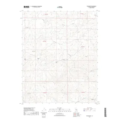
2018 Map of Pine Mountain
USGS Topo · Published 2018About this map
Sierra Nevada foothills dominate this landscape in eastern Kern County, defined by a complex network of steep drainages and isolated flats. The terrain is deeply incised by Poso Creek and its many tributaries, including Grimaud Cr and Five Dog Cr, which have carved out significant features like Borel Canyon and Adobe Canyon. This 2018 survey illustrates how topography dictates movement through the region, with Granite Rd and Pine Mountain Rd following the natural contours of the land.
Find a feature on this map
29 named features on this map. Tap any name to fly to it.
Don’t see what you’re looking for? This feature index may not catch every label — zoom into the map to look around manually.
Map Details
Editions of this 2018 Pine Mountain Map
This is the sole edition of this map. No revisions or reprints were ever made.
Other maps of this area

1906 · Bakersfield
USGS Topo · 1:62,500

1914 · Caliente
USGS Topo · 1:125,000

1920 · Delonagha
USGS Topo · 1:62,500

1926 · Glennville
USGS Topo · 1:62,500

1932 · Woody
USGS Topo · 1:62,500
1933 · Oil Center
USGS Topo · 1:31,680

1935 · Woody
USGS Topo · 1:62,500

1936 · Tobias Peak
USGS Topo · 1:125,000
1940 · Oil Center
USGS Topo · 1:31,680

1943 · Breckenridge Mountain
USGS Topo · 1:62,500