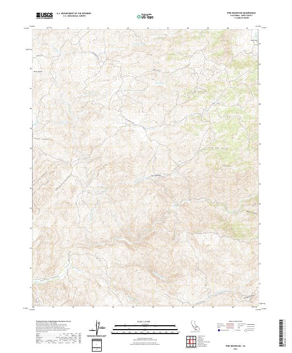
2021 Map of Pine Mountain
USGS Topo · Published 2021About this map
Pine Mtn and the western foothills of the Sierra Nevada define this landscape within Kern County. The complex drainage systems of Poso Cr and Rancheria Cr are prominent, cutting through numerous canyons such as Borel Canyon and Adobe Canyon. While the topography is dominant, the presence of the Poso Canal in the southwestern corner indicates the managed water infrastructure essential to this region of California. Access throughout the area is marked by winding routes like Granite Rd and Pine Mountain Rd, which navigate the steep elevations between Poso Flat and the deeper gulches. The survey illustrates a terrain defined by its watercourses, from the northern Five Dog Cr to the southern reaches of Rancheria Canyon, providing a detailed look at the physical geography before it descends toward the Central Valley.
Find a feature on this map
29 named features on this map. Tap any name to fly to it.
Don’t see what you’re looking for? This feature index may not catch every label — zoom into the map to look around manually.
Map Details
Editions of this 2021 Pine Mountain Map
This is the sole edition of this map. No revisions or reprints were ever made.
Other maps of this area

1906 · Bakersfield
USGS Topo · 1:62,500

1914 · Caliente
USGS Topo · 1:125,000

1920 · Delonagha
USGS Topo · 1:62,500

1926 · Glennville
USGS Topo · 1:62,500

1932 · Woody
USGS Topo · 1:62,500
1933 · Oil Center
USGS Topo · 1:31,680

1935 · Woody
USGS Topo · 1:62,500

1936 · Tobias Peak
USGS Topo · 1:125,000
1940 · Oil Center
USGS Topo · 1:31,680

1943 · Breckenridge Mountain
USGS Topo · 1:62,500