2021 Map of Pine Ridge
USGS Topo · Published 2021About this map
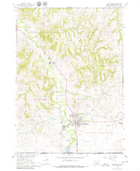
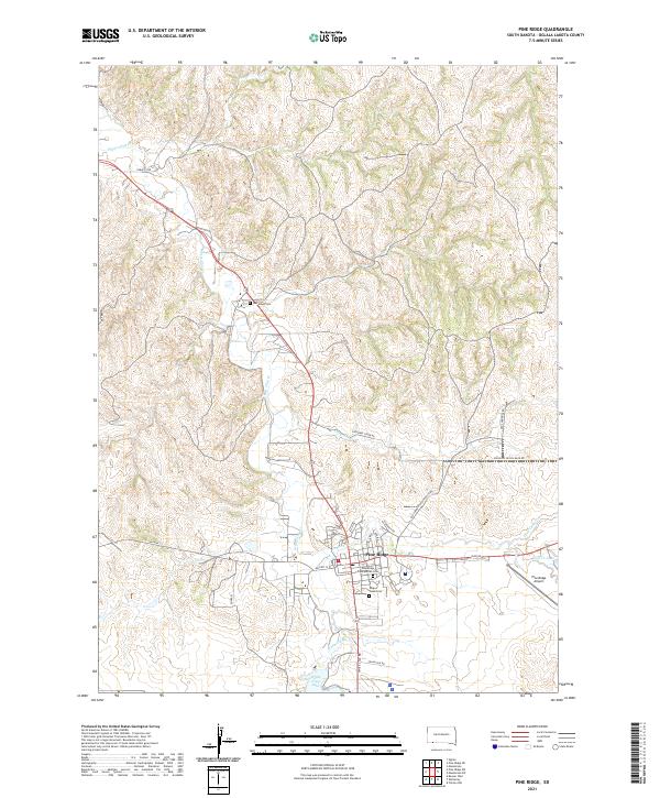
White Clay Cr and its tributaries carve a complex drainage pattern through this Oglala Lakota County landscape, anchoring the settlement of Pine Ridge. This 2021 survey details the spiritual and community centers of the area, including the Red Cloud Cem, Holy Cross Cem, and the Pine Ridge Presbyterian Cem. The geography is defined by a network of local roads such as Tobacco Rd and Merrival-Buffalo Rd that traverse the rolling terrain between water bodies like White Clay Lake and Wolf Cr Lake. The Pine Ridge Airport sits on the eastern edge of the community, highlighting the modern infrastructure supporting this hub. The map's detailed topography illustrates the transition from the creek bottoms of Cheyenne Cr to the higher elevations marked by the t36n r44w and t36n r45w township lines.
Find a feature on this map
29 named features on this map. Tap any name to fly to it.
Don’t see what you’re looking for? This feature index may not catch every label — zoom into the map to look around manually.
Map Details
Editions of this 2021 Pine Ridge Map
This is the sole edition of this map. No revisions or reprints were ever made.
Historical Maps of Pine Ridge Through Time
3 maps found