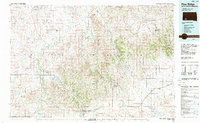
1985 Map of Pine Ridge
USGS Topo · Published 1988About this map
The Pine Ridge Indian Reservation dominates this mid-1980s topographic landscape, stretching from the edge of Badlands National Park south to the Nebraska state line. This survey provides a clear view of the Oglala Lakota heartland during a period of established community infrastructure, connecting settlements like Kyle, Manderson, and Porcupine via a network of secondary roads and tribal routes. The terrain is defined by the sharp transition from the flat elevations of Cuny Table and Red Dog Table to the intricate drainages of the White River and Wounded Knee Creek. Significant local landmarks include Lookout Porcupine Butte and Oglala Lake, while the southern border area features smaller rural hubs such as Batesland and Wakpamni near the Nebraska border with Shannon and Dawes Counties.
Find a feature on this map
49 named features on this map. Tap any name to fly to it.
Don’t see what you’re looking for? This feature index may not catch every label — zoom into the map to look around manually.
Map Details
Editions of this 1985 Pine Ridge Map
2 editions found

Other maps of this area

1894 · Hermosa
USGS Topo · 1:125,000

1896 · Oelrichs
USGS Topo · 1:125,000

1900 · Oelrichs
USGS Topo · 1:125,000

1901 · Hermosa
USGS Topo · 1:125,000

1950 · Stirk Table
USGS Topo · 1:24,000

1950 · Cuny Table East
USGS Topo · 1:24,000

1950 · Conata SW
USGS Topo · 1:24,000

1950 · Potato Creek
USGS Topo · 1:24,000

1950 · Imlay SW
USGS Topo · 1:24,000

1950 · Imlay SE
USGS Topo · 1:24,000