
1950 Map of Conata SW
USGS Topo · Published 1952About this map
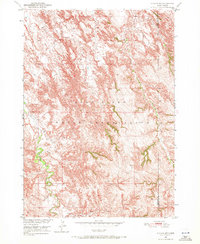
The Pine Ridge Indian Reservation landscape is defined by the sharp topographic contrasts of the South Dakota Badlands as they appeared during this 1950 field check. The drainage pattern of the Missouri River Basin is clearly visible here, as Redwater Creek and Medicine Root Creek carve deep, complex arterial systems through the high plains. The map records the historical political boundary between Shannon Co and Washabaugh Co, cutting across a terrain of high ridges and intricate draws. Further south, Mud Creek winds through the lower elevations, highlighting the remote nature of the territory before modern development. This survey was conducted as part of the Department of the Interior's efforts to document the Missouri River Basin, providing a precise look at the hydrology and landforms that shaped life in this corner of the reservation.
Find a feature on this map
5 named features on this map. Tap any name to fly to it.
Don’t see what you’re looking for? This feature index may not catch every label — zoom into the map to look around manually.
Map Details
Editions of this 1950 Conata SW Map
2 editions found
Other maps of this area

1950 · Conata
USGS Topo · 1:24,000

1950 · Imlay SE
USGS Topo · 1:24,000

1950 · Bouquet Table
USGS Topo · 1:24,000

1952 · Conata NE
USGS Topo · 1:24,000

1952 · Bouquet Table
USGS Topo · 1:24,000

1952 · Conata SE
USGS Topo · 1:24,000

1952 · Conata
USGS Topo · 1:24,000

1955 · Hot Springs
USGS Topo · 1:250,000

1981 · Wall
USGS Topo · 1:100,000

1981 · Kyle
USGS Topo · 1:25,000