Old Maps of Pine Ridge, South Dakota
Explore 133 old maps of Pine Ridge, spanning from 1896 to today. These high-resolution historic maps reveal how streets, neighborhoods, landmarks, and natural features evolved over time — perfect for genealogy, metal detecting, research, and local history exploration.
What you can do with these maps:
- See how Pine Ridge changed over time: Compare historical maps to modern-day views to trace roads, homesites, rail lines & more.
- View detailed metadata: Each map includes creators, publishers, year, scale, and archive source.
- Overlay maps with satellite & LiDAR: Visualize the past alongside modern tools to explore terrain & human change.
- Trusted historical sources: Maps sourced from the USGS, Library of Congress, and other archives.
- Access maps your way: View online, download high-res files, or order prints for personal or research use.
Start exploring old maps of Pine Ridge to uncover forgotten places, hidden landmarks, and the deep history beneath your feet.
Pine Ridge, SD maps
(133)- 1896 Map of Oelrichs
 1896 Oelrichs1896 Print · USGSThe southern Black Hills and Cheyenne River valley come alive in this late nineteenth-century survey of the South Dakota and Nebraska borderlands. Genealogists and historians can trace early rail-side towns and industrial sites like Hot Springs, Smithwick, and the Evans Quarry.
 - 1900 Map of Oelrichs
 1900 Oelrichs1900 Print · USGSFall River County at the close of the nineteenth century reveals a landscape defined by the arrival of the railroad and the growth of early quarrying operations. Genealogists and historians can trace the Missouri Valley and Elkhorn RR through stops like Buffalo Gap and Oelrichs.4 unique versions available
 - 1955 Map of Hot Springs, 1958 Print
 1955 Hot Springs1958 Print · USGSThe Black Hills and South Dakota badlands are captured here in the mid-fifties, during a peak of military and industrial activity. Researchers can locate the Black Hills Ordnance Depot, early Uranium Mines, and historic rail stops like Pringle or Oglala.5 unique versions available
 - 1955 Map of Alliance, 1966 Print
 1955 Alliance1966 Print · USGSThe Nebraska panhandle comes into sharp focus during the mid-fifties, showing a landscape defined by the Niobrara River and the expanding Sand Hills. Researchers can trace the grounds of Fort Robinson, locate Saint Marys Church, or follow the Chicago Burlington and Quincy rail line through Hemingford.3 unique versions available
 - 1957 Map of Alliance
 1957 Alliance1957 Print · USGSNorthwest Nebraska in the mid-fifties is captured here as a landscape of rail hubs, sprawling cattle ranches, and the eastern edge of the dunes. Genealogists and historians can trace rail lines through Alliance and Chadron or locate landmarks like Saint Marys Church and the Agate Spring Fossil Beds.
 - 1958 Map of Alliance
 1958 Alliance1958 Print · USGSNorthwestern Nebraska in the late fifties shows a landscape shaped by the legacy of the high plains frontier and modern agricultural expansion. Genealogists and historians can trace rail-line settlements and landmarks like Fort Robinson and the Agate Spring Fossil Beds.
 - 1967 Map of Pine Ridge SW, 1969 Print
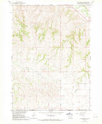 1967 Pine Ridge SW1969 Print · USGSThe South Dakota and Nebraska borderlands are captured here in the late sixties, highlighting the southern edge of the Oglala Lakota territory. Researchers can locate the Tashunke-Ko-Ki-Pa-Pi Cem and trace the paths of White Clay Creek and Janis Creek.
 - 1967 Map of Pine Ridge NE, 1969 Print
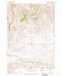
 1967 Pine Ridge NE1969 Print · USGSThe ranchlands of Shannon County are captured here in the late sixties as the Missouri River Basin development program shaped the landscape. Genealogists and historians can trace the Cooms Ranch homestead and the remote Landing Strip along Little Grass Creek.
 - 1967 Map of Pine Ridge, 1969 Print
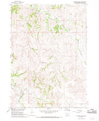
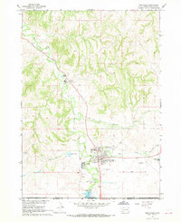 1967 Pine Ridge1969 Print · USGSPine Ridge and its surrounding reservation lands are captured in detail during the late sixties at the South Dakota border. Researchers can trace the development of community centers like Holy Rosary Sch and landmarks such as the Oglala-Sioux Sundance Arena.2 unique versions available
 - 1967 Map of Slim Butte SW, 1969 Print
 1967 Slim Butte SW1969 Print · USGSThe High Plains border of South Dakota and Nebraska comes into focus in the late sixties, where the prominent Slim Butte rises above the prairie. Researchers can trace the Pine Ridge Indian Reservation Boundary and locate the remote Wild Landing Field.2 unique versions available
 - 1967 Map of Slim Butte NW, 1969 Print
 1967 Slim Butte NW1969 Print · USGSShannon County in the late sixties reveals a landscape of winding drainages and rural outposts. Researchers can locate the isolated Swallow Ch and trace the paths of Blacktail Creek and Slim Butte Creek through this Missouri River Basin study.
 - 1967 Map of Manderson, 1969 Print
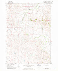
 1967 Manderson1969 Print · USGSManderson and the surrounding South Dakota prairie are documented here during the late sixties, centered on the Wounded Knee Creek valley. Genealogists and local historians can locate St Paul Cem and trace the paths of White Horse Creek and Pepper Creek.
 - 1967 Map of Oglala, 1969 Print
 1967 Oglala1969 Print · USGSThe Pine Ridge reservation area in the late sixties reveals a landscape shaped by water and community faith. Genealogists and local historians can trace landmarks like Our Lady of The Sioux Ch, St James Cem, and the waters of White Clay Creek.
 - 1967 Map of Slim Butte NE, 1970 Print
 1967 Slim Butte NE1970 Print · USGSThe Oglala Lakota plains are documented in the late sixties, showing a landscape shaped by the winding White River. Researchers can locate community centers like the Oglala Sch, Makasan Ch, and family landmarks near Slim Butte.
 - 1967 Map of Slim Butte, 1970 Print
 1967 Slim Butte1970 Print · USGSThe Pine Ridge Indian Reservation borderlands are captured here in the late sixties as the White River winds through the South Dakota-Nebraska line. Researchers can locate remote community landmarks like Holy Guardian Angel Ch and St Matthew Ch Cem near Slim Butte.
 - 1967 Map of Manderson SW, 1970 Print
 1967 Manderson SW1970 Print · USGSThe Pine Ridge Indian Reservation landscape comes into focus during the late sixties at the South Dakota and Nebraska border. Genealogists and historians can locate family burial sites at St Anns Cem and Lamont Cem or trace the historic Big Foot Trail.
 - 1967 Map of Wounded Knee, 1970 Print
 1967 Wounded Knee1970 Print · USGSShannon County in the late sixties reveals a landscape shaped by historical routes and secluded missions. Genealogists and historians can trace the paths of the Big Foot Trail and locate family sites at Our Lady of Lourdes Mission or St Julia Cem.
 - 1967 Map of Denby, 1970 Print
 1967 Denby1970 Print · USGSThe Pine Ridge Indian Reservation borderlands come into focus in the late sixties, showcasing a landscape of winding creeks and early travel routes. Researchers can locate the Native American Cem, trace the historic Big Foot Trail, and explore the area around Denby.
 - 1969 Map of Whiteclay, 1971 Print
 1969 Whiteclay1971 Print · USGSThe Nebraska-South Dakota borderlands are captured here in the late sixties, where the Whiteclay (Dewing) settlement meets the Pine Ridge area. Genealogists and historians can trace the Old Indian Treaty Boundary or locate sites like Extension Chapel and Abold Cem.
 - 1969 Map of Clinton NW, 1971 Print
 1969 Clinton NW1971 Print · USGSThe Nebraska-South Dakota borderlands come into focus in the late 1960s, showing the intersection of tribal lands and ranching history. Researchers can locate the Old Indian Treaty Boundary and trace local sites like Mt Maria, Mission Ranch, and a small Cem.
 - 1969 Map of Clinton NE, 1971 Print
 1969 Clinton NE1971 Print · USGSThe Nebraska-South Dakota borderlands come into focus in the late sixties as ranching and rural life defined the Sheridan County landscape. Genealogists and researchers can trace local landmarks like Bethel Cem, Albany Pine Lodge Sch, and the winding Wounded Knee Creek.
 - 1969 Map of Beaver Wall, 1971 Print
 1969 Beaver Wall1971 Print · USGSSheridan County, Nebraska, sits at a historical crossroads in the late sixties where state lines and tribal lands meet. Genealogists and historians can trace rural school locations like Craven Creek Sch and the significant Old Indian Treaty Boundary.
 - 1969 Map of Chadron NE, 1972 Print
 1969 Chadron NE1972 Print · USGSDawes County, Nebraska, and the South Dakota borderlands are captured here in the late sixties, showing a landscape of deep creek breaks and river valleys. Researchers can locate remote rural landmarks like the Beaver Valley Cem, Friends Ch, and the high point at Limekiln.
 - 1969 Map of Hog Island, 1972 Print
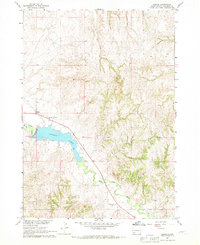
 1969 Hog Island1972 Print · USGSThe Nebraska Sandhills at the South Dakota border are captured here in the late sixties, showing the vast network of lakes and marshes south of the Pine Ridge Indian Reservation Boundary. Researchers can trace the unique hydrology of Hog Island, Shell Lake, and the winding Meadow Horseshoe Ditch.
 - 1969 Map of Gordon NW, 1972 Print
 1969 Gordon NW1972 Print · USGSThe Nebraska-South Dakota borderlands come into focus in the late sixties, showing the rural landscape where ranching and reservation lands meet. Genealogists and local historians can locate the North Star Sch, Fieldside Sch, and landmarks like Frye Lake.
Showing maps 1-25 of 133
Top neighborhoods of Pine Ridge
Frequently asked questions
- What are the different types of historical maps available for Pine Ridge?
- What is the oldest map of Pine Ridge?
- Where can I purchase historical maps of Pine Ridge for my home or office?
- Where can I download high-res historical maps of Pine Ridge?
- Are there historical topographic maps available for Pine Ridge?
- Is there historical aerial imagery available for Pine Ridge?
- Where are historical maps of Pine Ridge sourced from?