
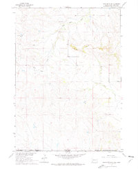
1967 Map of Slim Butte SW
USGS Topo · Published 1969About this map
Slim Butte dominates the northern reaches of this High Plains landscape, where the broken topography of the butte formations meets the sweeping prairie along the South Dakota and Nebraska border. This 1967 field-checked survey documents a transition in the land's management and identity, clearly marking the Pine Ridge Indian Reservation Boundary as it cuts across the section lines. The drainage patterns of Slim Butte Creek and Alkali Creek define the local hydrology, while the isolated Wild Landing Field suggests the continued importance of small-scale aviation for remote ranching and land management in the mid-twentieth century. The southern portion of the map transition into the East Chadron area of Nebraska, showing the sparse network of unimproved roads and livestock fences that characterize this borderland region.
Find a feature on this map
6 named features on this map. Tap any name to fly to it.
Don’t see what you’re looking for? This feature index may not catch every label — zoom into the map to look around manually.
Map Details
Editions of this 1967 Slim Butte SW Map
2 editions found
Other maps of this area

1896 · Oelrichs
USGS Topo · 1:125,000

1900 · Oelrichs
USGS Topo · 1:125,000

1955 · Hot Springs
USGS Topo · 1:250,000

1955 · Alliance
USGS Topo · 1:250,000

1957 · Alliance
USGS Topo · 1:250,000

1958 · Alliance
USGS Topo · 1:250,000

1967 · Slim Butte NW
USGS Topo · 1:24,000

1967 · Slim Butte NE
USGS Topo · 1:24,000

1967 · Slim Butte
USGS Topo · 1:24,000

1969 · Chadron NE
USGS Topo · 1:24,000