
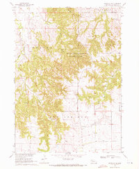
1969 Map of Chadron NE
USGS Topo · Published 1972About this map
The White River flows through the northern reaches of this landscape, carving a path through the Nebraska borderlands near the South Dakota line. This 1969 survey captures the rugged breaks of East Chadron and Beaver, where the topography shifts from river bottomlands to complex ridgelines. The southeastern corner of the map reveals a pocket of community life centered around the Beaver Creek drainage, featuring the Friends Ch and the Beaver Valley Cem. Significant for local historians, the map also identifies Limekiln in the northeast, suggesting early industrial activity or geological landmarks in a territory otherwise defined by its intricate drainage networks and wide-open rangeland. Boundary lines for Dawes and Shannon counties intersect here, reflecting the administrative divisions of the high plains during the late 1960s.
Find a feature on this map
11 named features on this map. Tap any name to fly to it.
Don’t see what you’re looking for? This feature index may not catch every label — zoom into the map to look around manually.
Map Details
Editions of this 1969 Chadron NE Map
This is the sole edition of this map. No revisions or reprints were ever made.
Other maps of this area

1955 · Hot Springs
USGS Topo · 1:250,000

1955 · Alliance
USGS Topo · 1:250,000

1957 · Alliance
USGS Topo · 1:250,000

1958 · Alliance
USGS Topo · 1:250,000

1967 · Pine Ridge SW
USGS Topo · 1:24,000

1967 · Slim Butte SW
USGS Topo · 1:24,000

1967 · Slim Butte
USGS Topo · 1:24,000

1969 · Beaver Wall
USGS Topo · 1:24,000

1969 · Bordeaux
USGS Topo · 1:24,000
1969 · Whiteclay SW
USGS Topo · 1:24,000