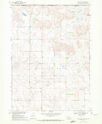
1969 Map of Gordon NW
USGS Topo · Published 1972About this map
Wounded Knee marks the central terrain of this 1969 survey, where the rolling Nebraska landscape meets the Indian Reservation Boundary at the South Dakota border. This document, produced as part of the Department of the Interior’s program for the Missouri River Basin, reveals a rural ranching and farming landscape characterized by isolated schoolhouses and essential water sources. The map identifies the North Star Sch and Fieldside Sch, which served the local families spread across the hills of Shannon and Sheridan counties. Industry is represented by localized extraction sites such as a Gravel Pit and Sandpit, while natural features like Frye Lake, Margrave, and Meadow provide the primary geographic landmarks in this sparsely populated borderland.
Find a feature on this map
12 named features on this map. Tap any name to fly to it.
Don’t see what you’re looking for? This feature index may not catch every label — zoom into the map to look around manually.
Map Details
Editions of this 1969 Gordon NW Map
This is the sole edition of this map. No revisions or reprints were ever made.
Other maps of this area

1955 · Hot Springs
USGS Topo · 1:250,000

1955 · Alliance
USGS Topo · 1:250,000

1957 · Alliance
USGS Topo · 1:250,000

1958 · Alliance
USGS Topo · 1:250,000

1967 · Denby
USGS Topo · 1:24,000

1969 · Gordon
USGS Topo · 1:24,000
1969 · Gordon SE
USGS Topo · 1:24,000

1969 · Clinton
USGS Topo · 1:24,000

1969 · Clinton NE
USGS Topo · 1:24,000
1969 · Hog Island
USGS Topo · 1:24,000