
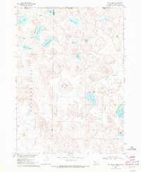
1969 Map of Gordon
USGS Topo · Published 1971About this map
The high plains of Sheridan County center on the hub city of Gordon, where the Chicago and North Western railroad provides a vital lifeline for agricultural transport. This 1969 survey captures the community's local infrastructure, including the Gordon Municipal Airport and a nearby Drive-in Theater along the highway. To the west, the landscape is defined by the managed flow of Antelope Creek and the Webster Dam, which supports a spillway at an elevation of 3577 feet.
Find a feature on this map
23 named features on this map. Tap any name to fly to it.
Don’t see what you’re looking for? This feature index may not catch every label — zoom into the map to look around manually.
Map Details
Editions of this 1969 Gordon Map
This is the sole edition of this map. No revisions or reprints were ever made.
Other maps of this area

1955 · Alliance
USGS Topo · 1:250,000

1957 · Alliance
USGS Topo · 1:250,000

1958 · Alliance
USGS Topo · 1:250,000
1969 · Gordon SE
USGS Topo · 1:24,000

1969 · Clinton
USGS Topo · 1:24,000

1969 · Clinton NE
USGS Topo · 1:24,000
1969 · Rushville 4 NE
USGS Topo · 1:24,000
1969 · Rushville 4 NW
USGS Topo · 1:24,000
1969 · Rushville NE
USGS Topo · 1:24,000
1969 · Hog Island
USGS Topo · 1:24,000