2020s Maps of Pine Ridge, South Dakota
Explore 25 historic maps of Pine Ridge from the 2020s. These maps offer a rare glimpse into what life looked like during the 2020s — showing old roads, neighborhoods, homes, and landmarks that have changed or disappeared over time.
Whether you're researching your family's past, planning a metal detecting trip, or studying how Pine Ridge's landscape evolved across the 2020s, these high-resolution maps are a powerful tool for exploring the history of this region.
- Focus on a specific era: All maps on this page are from the 2020s, giving you a focused view of this time period.
- See what’s changed: Compare century-old streets, trails, and buildings to today's modern landscape using overlays and satellite layers.
- Research with precision: Use these maps for genealogy, historical research, land use analysis, or educational projects.
- View, download, or print: Maps are fully viewable online in high resolution, and can be downloaded or printed for your own records.
Start exploring Pine Ridge's history through authentic maps from the 2020s. This is your window into the past.
Pine Ridge, SD maps
(25)- 2021 Map of Clinton NE, 2021 Print
 2021 Clinton NE2021 Print · USGSSheridan County, Nebraska, is documented here in the early 2020s, showing a sprawling landscape of ridges and creek drainages. Researchers can locate the Bethel Cem and trace the paths of Wounded Knee Cr and Holzberger Reservoir.
 - 2021 Map of Hog Island, 2021 Print
 2021 Hog Island2021 Print · USGSThe Nebraska Sandhills on the Sheridan and Cherry county line are captured here in the early 2020s. Researchers can trace the unique hydrology of this cattle country through features like Hog Island, Shell Lake, and the Horseshoe Drainage Ditch.
 - 2021 Map of Beaver Wall, 2021 Print
 2021 Beaver Wall2021 Print · USGSSheridan County's high plains and dramatic bluffs are captured in this modern survey of northwestern Nebraska. Researchers can trace the rugged topography of Beaver Wall and Hubbard Butte alongside local water sources like Colwell Reservoir.
 - 2021 Map of Clinton NW, 2021 Print
 2021 Clinton NW2021 Print · USGSSheridan County's high plains are captured here in the early twenty-first century, showing the drainage patterns near the South Dakota border. Researchers can locate family landmarks and water sources like Mt Maria, Otte Reservoir, and the winding Larrabee Cr.
 - 2021 Map of Whiteclay, 2021 Print
 2021 Whiteclay2021 Print · USGSSheridan County, Nebraska, near the state border, is documented here in the early 2020s. Researchers can locate the Abold Cemetery or trace the drainage paths of White Clay Creek and Larrabee Creek through this sparsely populated landscape.
 - 2021 Map of Chadron NE, 2021 Print
 2021 Chadron NE2021 Print · USGSThe Nebraska panhandle landscape near the Sheridan and Dawes county line is documented here in the early 2020s. Researchers can locate family landmarks like the Beaver Valley Cemetery and trace the paths of White River and Slim Butte Road.
 - 2021 Map of Gordon NW, 2021 Print
 2021 Gordon NW2021 Print · USGSSheridan County ranch lands in the Nebraska Sandhills are mapped here in the early 2020s. Researchers can trace the section-line roads and remote terrain features of this cattle country, including Margrave Meadow, 763rd Trl, and 730th Rd.
 - 2021 Map of Manderson, 2021 Print
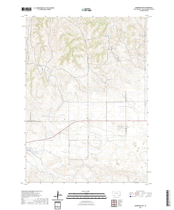
 2021 Manderson2021 Print · USGSManderson and the Pine Ridge Reservation are captured here in the early twenty-first century as the landscape follows the winding Wounded Knee Cr. Trace local heritage at Saint Agnes Catholic Cem or follow the path of Big Foot Trl across the high plains.
 - 2021 Map of Wounded Knee, 2021 Print
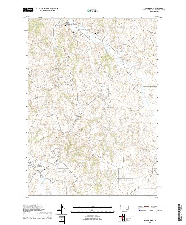 2021 Wounded Knee2021 Print · USGSThe Pine Ridge Indian Reservation is documented here in the early twenty-first century, centered on the historic site of Wounded Knee. Researchers can trace local genealogy and landmarks through sites like the Wounded Knee Monument, Saint Julia Cem, and the Big Foot Trl.
 - 2021 Map of Two Lance Lake, 2021 Print
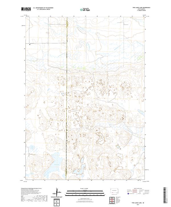 2021 Two Lance Lake2021 Print · USGSBennett and Oglala Lakota counties are mapped here in the early 2020s, showing a landscape defined by prairie wetlands and river drainages. Genealogists and researchers can locate the Knight Cem and trace the paths of Stinking Water Cr and the Little White River.
 - 2021 Map of Pine Ridge NE, 2021 Print
 2021 Pine Ridge NE2021 Print · USGSOglala Lakota County's terrain is documented here in the early 2020s, showcasing the intricate drainage systems of the northern plains. Trace the paths of Little Grass Creek, Pepper Creek, and the route of White Horse Creek Rd.
 - 2021 Map of Slim Butte NE, 2021 Print
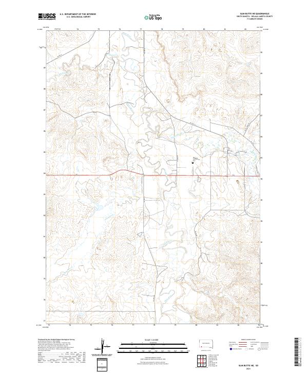 2021 Slim Butte NE2021 Print · USGSOglala Lakota County is shown here in the early 2020s, dominated by the winding path of the White River. Genealogists can trace family-named landmarks like Sauser Rd or Looking Elk Rd and the Makasan Presbyterian Cem.
 - 2021 Map of Slim Butte SW, 2021 Print
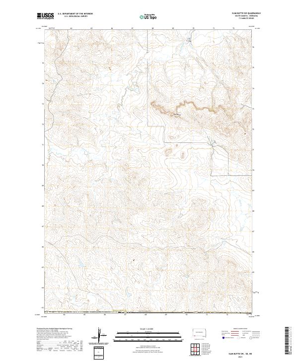 2021 Slim Butte SW2021 Print · USGSThe high plains of Oglala Lakota County are captured here in the early twenty-first century, showcasing a landscape of dramatic plateaus and seasonal water. Researchers can trace the drainage patterns of Slim Butte Cr and Alkali Cr around the prominent Slim Butte.
 - 2021 Map of Batesland NW, 2021 Print
 2021 Batesland NW2021 Print · USGSOglala Lakota County, South Dakota, is mapped here in the early 2020s, showcasing the high-plains landscape before its recent shifts. Researchers can trace rural routes like American Horse Creek Rd across the drainage of Porcupine Cr and the Little White River.
 - 2021 Map of Pine Ridge, 2021 Print
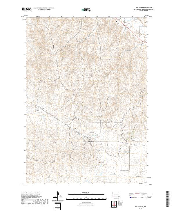
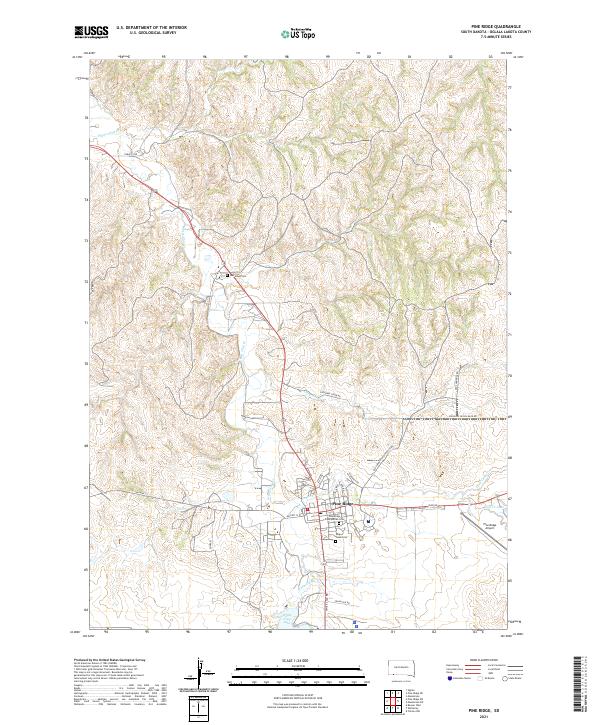 2021 Pine Ridge2021 Print · USGSPine Ridge and the surrounding Oglala Lakota County landscape are captured in this contemporary survey of the High Plains. Genealogists and historians can trace local heritage through sites like Red Cloud Cem, Holy Cross Cem, and Wolf Cr Lake.
 - 2021 Map of Oglala, 2021 Print
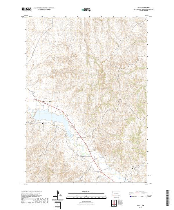 2021 Oglala2021 Print · USGSOglala Lakota County comes into focus in this recent survey, showcasing the community of Oglala and its surrounding prairie landscape. Genealogists can locate vital landmarks like Our Lady of the Sioux Cem and Saint Peter Church Cem.
 - 2021 Map of Heinne Creek, 2021 Print
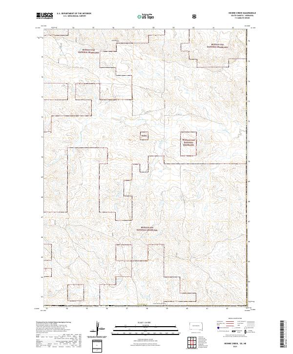 2021 Heinne Creek2021 Print · USGSFall River County in the early 2020s remains a vast expanse of protected prairie within the Buffalo Gap National Grassland. Researchers can trace the winding paths of Heinne Cr and Slim Butte Cr as they flow past landmarks like Lone Butte.
 - 2021 Map of Batesland, 2021 Print
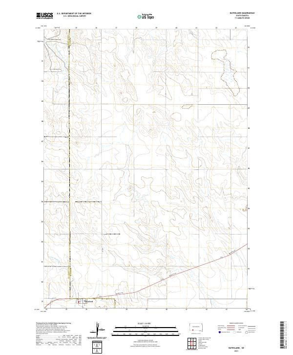 2021 Batesland2021 Print · USGSThe settlement of Batesland and the surrounding plains are captured in this recent survey of the South Dakota borderlands. Researchers can trace the winding Little White River and follow the paths of American Horse Cr and No Flesh Cr across the county line.
 - 2021 Map of Pine Ridge SW, 2021 Print
 2021 Pine Ridge SW2021 Print · USGSOglala Lakota County in the early twenty-first century is defined by its deep creek valleys and essential road networks across the Pine Ridge Reservation. Genealogists and researchers can locate Tashunke - Ko - Ki - Pa - Pi Cem and trace paths along Janis Cr or Slim Buttes Rd.
 - 2021 Map of Manderson SW, 2021 Print
 2021 Manderson SW2021 Print · USGSOglala Lakota County is mapped here in the early 2020s, showing a landscape shaped by the winding prongs of Wolf Creek and historic trails. Researchers can locate Saint Ann's Cem and Lamont Cem, or trace the path of the Big Foot Trl and Old Wolf Cr Sch Rd.
 - 2021 Map of Slim Butte NW, 2021 Print
 2021 Slim Butte NW2021 Print · USGSOglala Lakota County is mapped here in the modern era, showing the rural landscape and tribal infrastructure. Local historians can trace the location of Swallow Church Cem and follow the paths of Blacktail Creek and BIA Road 52.
 - 2021 Map of Denby, 2021 Print
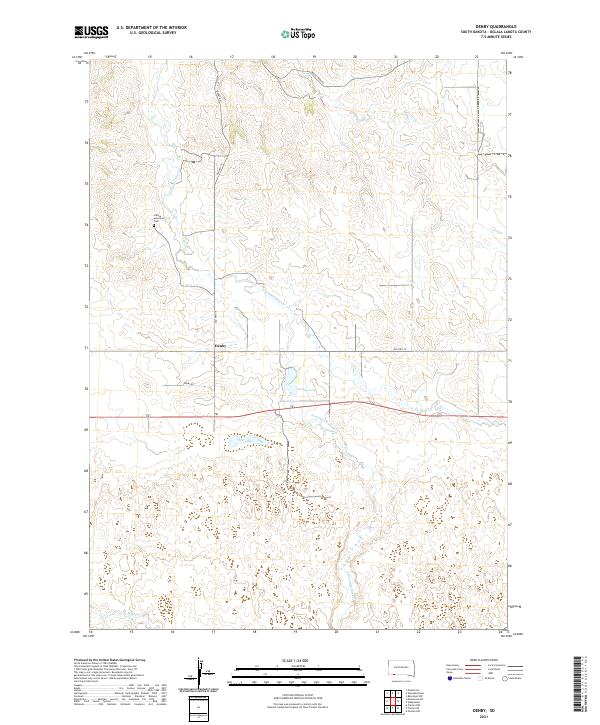 2021 Denby2021 Print · USGSThe Oglala Lakota prairie comes into sharp focus in this modern survey of the South Dakota plains. Genealogists and local historians can trace the rural roads around the settlement of Denby and locate water features like Denby Lake and Lee Lake.
 - 2021 Map of Oelrichs NE, 2021 Print
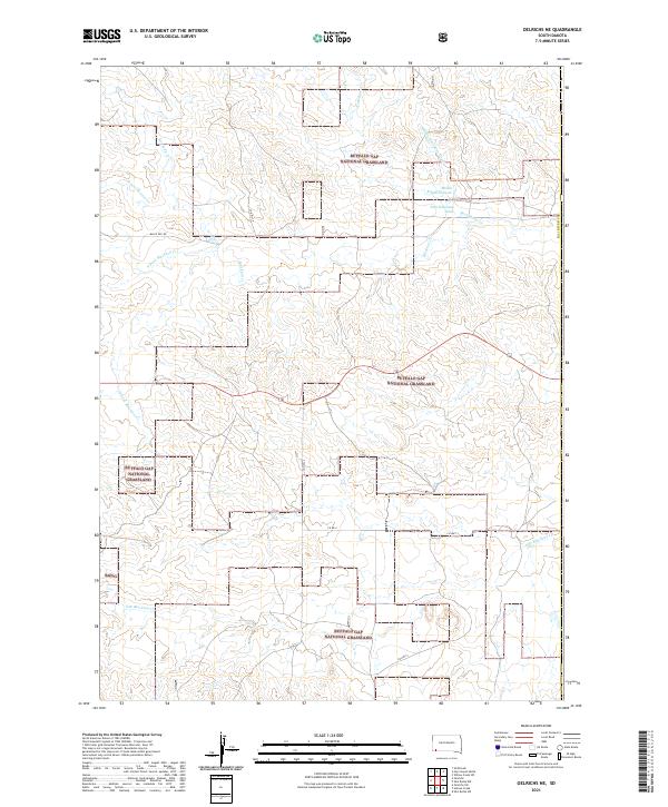 2021 Oelrichs NE2021 Print · USGSFall River County, South Dakota, is captured here in the early 2020s, showing the sprawling public lands of the Buffalo Gap National Grassland. Researchers can trace the dendritic drainage patterns of Blacktail Creek and locate remote landmarks like West Kneebone Draw and Rock Butte Creek.
 - 2021 Map of Wakpamani, 2021 Print
 2021 Wakpamani2021 Print · USGSThe Pine Ridge region in South Dakota comes into focus through its local road networks and tribal lands in this recent survey. Genealogists and historians can locate Feather on Head Cem and trace the shores of Wakpamani Lake and Feather on Head Lake.
 - 2021 Map of Slim Butte, 2021 Print
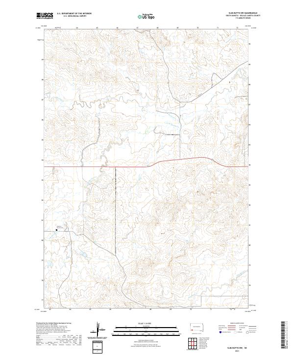
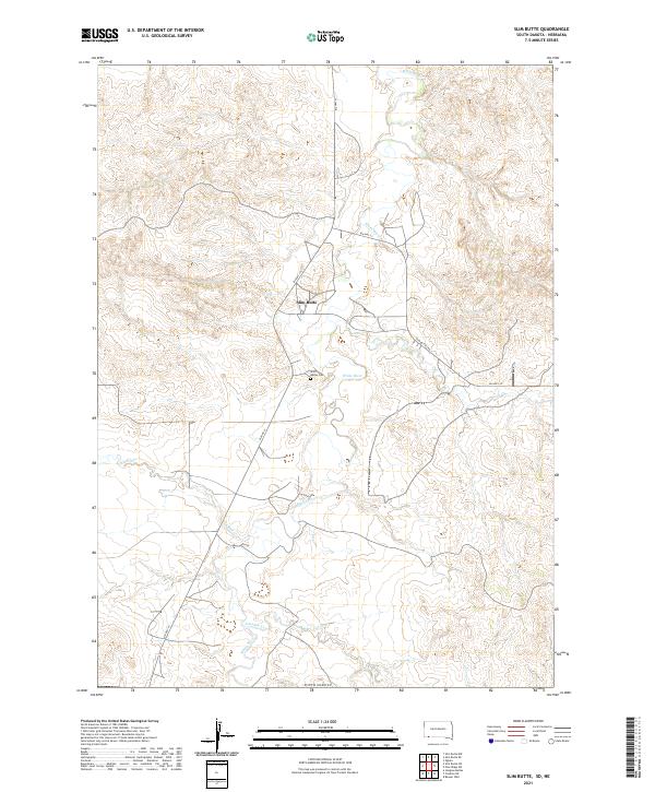 2021 Slim Butte2021 Print · USGSIn the Oglala Lakota region, this modern survey documents the high plains landscape and the winding path of the White River. Family historians and researchers can trace local landmarks like Slim Butte, the Slim Buttes Cem, and the path of BIA HWY 41.
End of results
Showing maps 1-25 of 25
Top neighborhoods of Pine Ridge
Frequently asked questions
- What are the different types of historical maps available for Pine Ridge?
- What is the oldest map of Pine Ridge?
- Where can I purchase historical maps of Pine Ridge for my home or office?
- Where can I download high-res historical maps of Pine Ridge?
- Are there historical topographic maps available for Pine Ridge?
- Is there historical aerial imagery available for Pine Ridge?
- Where are historical maps of Pine Ridge sourced from?