2021 Map of Batesland
USGS Topo · Published 2021About this map
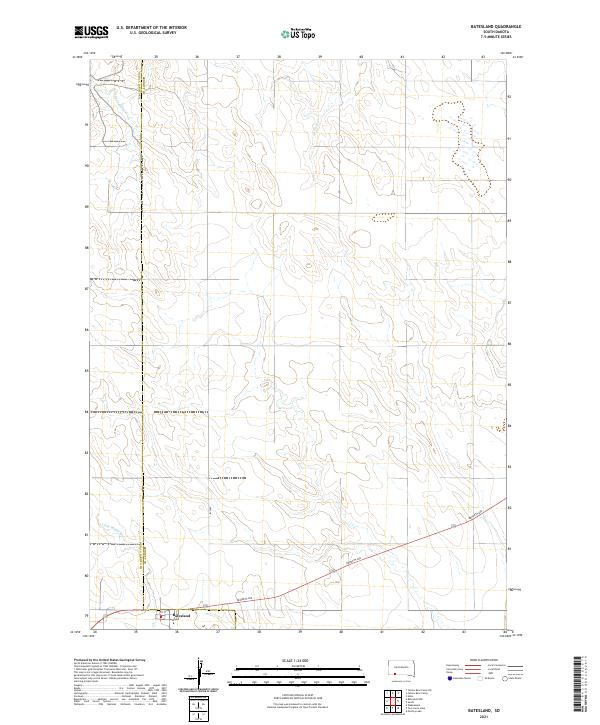
Batesland sits at the intersection of Bennett Ave and Hwy 18, serving as a focal point in this southern South Dakota landscape. The map highlights the transition between Oglala Lakota Co and Bennett Co, illustrating how political boundaries overlay the natural drainage patterns of the region. The southern portion of the quadrangle is defined by the winding path of the Little White River, while northern drainages include American Horse Cr and No Flesh Cr. The grid of the Public Land Survey System, including t37n r40w and t36n r41w, provides a framework for the rural roads and sparse development characteristic of this High Plains environment. This survey provides a contemporary view of the road network, including 1st St, as it serves the small settlement and surrounding ranchland.
Find a feature on this map
14 named features on this map. Tap any name to fly to it.
Don’t see what you’re looking for? This feature index may not catch every label — zoom into the map to look around manually.
Map Details
Editions of this 2021 Batesland Map
This is the sole edition of this map. No revisions or reprints were ever made.