Loading...
Loading map...2022 Map of Pine River
USGS Topo · Published 2022About this map
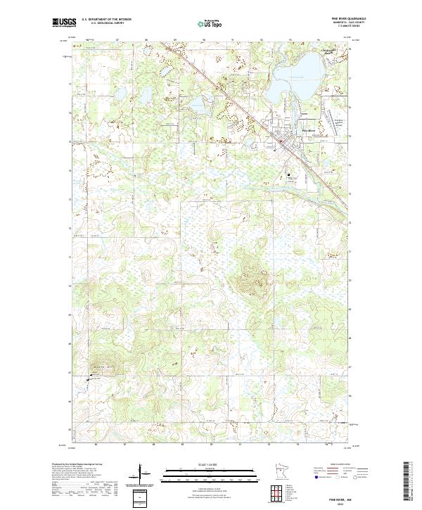
Pine River serves as the primary hub in this portion of Cass County, situated where the Pine River and its various branches create a complex hydrographic network. The landscape is defined by extensive wetlands such as the Rice Lake Swamp and numerous glacial lakes, including Norway Lake and Sand Lake. The town's layout is clearly visible with streets like Barclay Ave and Front St forming the community core near the Pine River Regional Airport.
Find a feature on this map
66 named features on this map. Tap any name to fly to it.
Don’t see what you’re looking for? This feature index may not catch every label — zoom into the map to look around manually.
Map Details
Date Portrayed2022
Date Published2022
PublisherU.S. Geological Survey
Map TypeTopographic
Scale1:24000
Physical Dimensions24 x 29 inches
Editions of this 2022 Pine River Map
This is the sole edition of this map. No revisions or reprints were ever made.
Historical Maps of Pine River Through Time
3 maps found
Featured Locations
Source Details
SourceU.S. Geological Survey
CopyrightPublic Domain