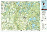
1976 Map of Pine River
USGS Topo · Published 1994About this map
Chippewa National Forest and Paul Bunyan State Forest dominate this northern landscape, which was updated with 1991 aerial photography to reflect the growing lakefront communities in Cass and Crow Wing counties. The map details a complex network of glacial lakes, including the sprawling Pelican Lake and the connected waters of Upper Whitefish Lake and Lower Whitefish Lake. These waters have long served as the foundation for the region's recreational economy, visible in the concentration of settlements like Breezy Point and Nisswa.
Find a feature on this map
83 named features on this map. Tap any name to fly to it.
Don’t see what you’re looking for? This feature index may not catch every label — zoom into the map to look around manually.
Map Details
Editions of this 1976 Pine River Map
This is the sole edition of this map. No revisions or reprints were ever made.
Other maps of this area

1912 · Deerwood
USGS Topo · 1:62,500

1913 · Cuyuna
USGS Topo · 1:62,500

1914 · Deerwood
USGS Topo · 1:62,500

1915 · Cuyuna
USGS Topo · 1:62,500

1915 · Brainerd
USGS Topo · 1:62,500

1916 · Pillager
USGS Topo · 1:62,500

1918 · Brainerd
USGS Topo · 1:62,500

1919 · Pillager
USGS Topo · 1:62,500

1919 · Leader
USGS Topo · 1:62,500

1953 · Duluth
USGS Topo · 1:250,000