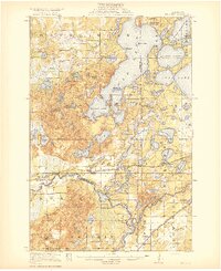
1919 Map of Pillager
USGS Topo · Published 1919About this map
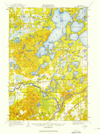
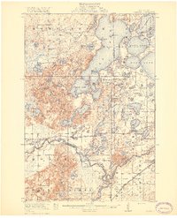
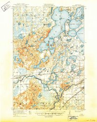
Gull Lake dominates this central Minnesota landscape, its intricate shoreline of points like Harrison Point and Keens Pt reflecting the area's development as a nascent retreat before the Great War. The map captures the famous Grand View Lodge on the northern shores of Gull Lake, while the surrounding countryside is dotted with rural educational landmarks like Plumly School and Rush Brook School. The Northern Pacific railroad corridor serves as the primary artery of commerce, connecting the settlements of Pillager and Baxter across a terrain defined by the winding Gull River.
Find a feature on this map
73 named features on this map. Tap any name to fly to it.
Don’t see what you’re looking for? This feature index may not catch every label — zoom into the map to look around manually.
Map Details
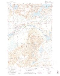
Editions of this 1919 Pillager Map
3 editions found
Historical Maps of Baxter Through Time
8 maps found