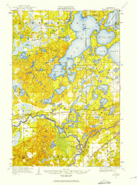
1916 Map of Pillager
USGS Topo · Published 1975About this map
The Mississippi River and Gull River converge in this 1916 survey, a landscape defined by the complex aquatic network of central Minnesota. The early development of the region's tourism and industrial infrastructure is visible at Grand View Lodge on Gull Lake and the Crow Wing Dam. The map captures a high density of rural schoolhouses, such as Snow School, Plumly School, and Hardy School, which served the scattered agricultural and logging communities of the era. Transportation is dominated by the Northern Pacific railroad and the Little Falls and Brainerd Branch, which linked settlements like Pillager, Baxter, and Crow Wing. This record preserves the original names of numerous points and islands, including Rock Island and Harrison Point, before modern shoreline development further altered the lake country.
Find a feature on this map
66 named features on this map. Tap any name to fly to it.
Don’t see what you’re looking for? This feature index may not catch every label — zoom into the map to look around manually.
Map Details
Editions of this 1916 Pillager Map
2 editions found
Other maps of this area

1915 · Brainerd
USGS Topo · 1:62,500

1916 · Pillager
USGS Topo · 1:62,500

1918 · Brainerd
USGS Topo · 1:62,500

1919 · Pillager
USGS Topo · 1:62,500

1919 · Leader
USGS Topo · 1:62,500

1948 · Belle Prairie
USGS Topo · 1:62,500

1948 · Lastrup
USGS Topo · 1:62,500

1948 · Cushing
USGS Topo · 1:62,500

1950 · Lastrup
USGS Topo · 1:62,500

1950 · Belle Prairie
USGS Topo · 1:62,500