
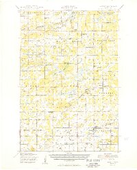
1950 Map of Lastrup
USGS Topo · Published 1950About this map
The Platte River and its numerous tributaries, including Daggett Brook and Mink Creek, define the rural landscape of eastern Morrison County in the late 1940s. Small agricultural settlements like Lastrup and Harding serve as local hubs, characterized by a dense network of country schoolhouses such as District No 36 School and District No 128 School. The cultural geography of the region is anchored by traditional parish centers, notably the Holy Cross Church and Holy Mother of Rosary Church, alongside civic gathering points like Granite Town Hall.
Find a feature on this map
75 named features on this map. Tap any name to fly to it.
Don’t see what you’re looking for? This feature index may not catch every label — zoom into the map to look around manually.
Map Details
Editions of this 1950 Lastrup Map
2 editions found
Other maps of this area

1912 · Deerwood
USGS Topo · 1:62,500

1914 · Deerwood
USGS Topo · 1:62,500

1915 · Brainerd
USGS Topo · 1:62,500

1916 · Pillager
USGS Topo · 1:62,500

1918 · Brainerd
USGS Topo · 1:62,500

1919 · Pillager
USGS Topo · 1:62,500

1948 · Belle Prairie
USGS Topo · 1:62,500

1948 · Pierz
USGS Topo · 1:62,500

1948 · Lastrup
USGS Topo · 1:62,500

1948 · Little Falls
USGS Topo · 1:62,500