
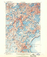
1912 Map of Deerwood
USGS Topo · Published 1963About this map
The Northern Pacific railroad line anchors the northern corridor of this 1912 survey, connecting the burgeoning mining and timber settlements of Crosby, Ironton, and Deerwood. This era of development is defined by a dense network of rural one-room schoolhouses, such as School No 76 and Katrine School, serving isolated homesteads scattered through the lake-heavy landscape. The terrain is characterized by an immense concentration of water bodies, ranging from the massive northern shore of Mille Lacs Lake to intricate chains like Borden Lake and Serpent Lake.
Find a feature on this map
93 named features on this map. Tap any name to fly to it.
Don’t see what you’re looking for? This feature index may not catch every label — zoom into the map to look around manually.
Map Details
Editions of this 1912 Deerwood Map
2 editions found
Other maps of this area

1913 · Cuyuna
USGS Topo · 1:62,500

1914 · Deerwood
USGS Topo · 1:62,500

1914 · Aitkin
USGS Topo · 1:62,500

1915 · Aitkin
USGS Topo · 1:62,500

1915 · Cuyuna
USGS Topo · 1:62,500

1915 · Brainerd
USGS Topo · 1:62,500

1916 · Wealthwood
USGS Topo · 1:62,500

1918 · Brainerd
USGS Topo · 1:62,500

1948 · Lastrup
USGS Topo · 1:62,500

1950 · Lastrup
USGS Topo · 1:62,500