1912 Map of Deerwood
USGS Topo · Published 1969About this map
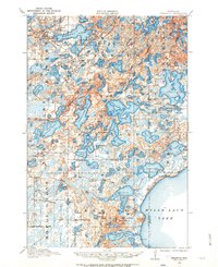
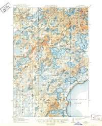
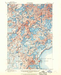
Mille Lacs Lake dominates the southeastern corner of this 1912 survey, providing a clear view of the shoreline before decades of development. The landscape is a dense network of glacial basins, where the waters of Bay Lake and Farm Island Lake are surrounded by small rural school districts and family landmarks. This era marks the height of the Cuyuna Iron Range boom, evidenced by the industrial footprints of Crosby and Ironton in the northwest. These mining centers are heavily served by the Northern Pacific and Soo Line railroads, which cut through the complex terrain of Serpent Lake. Local history is preserved through numerous rural school sites like Eaton School and School No 25, alongside the remote Davis Church and small settlements like Garrison and Bennettville. The map illustrates the transition from a wilderness of timber and water to a region defined by mineral extraction and early lakeside residency.
Find a feature on this map
98 named features on this map. Tap any name to fly to it.
Don’t see what you’re looking for? This feature index may not catch every label — zoom into the map to look around manually.
Map Details
Editions of this 1912 Deerwood Map
2 editions found