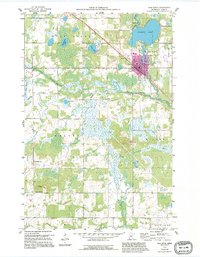
1959 Map of Pine River
USGS Topo · Published 1995About this map
The town of Pine River serves as the focal point of this northern Minnesota landscape, situated at the junction where the Pine River flows from Norway Lake. This mid-century survey, updated in the 1990s, illustrates the transition from the town's dense grid to the surrounding townships of Barclay, Walden, and Wilson. To the north, the lakeside community of Chickamaw Beach borders the water, while the interior is defined by a mosaic of wetlands like the Rice Lake Swamp and numerous smaller basins including Sand Lake and Tamarack Lake.
Find a feature on this map
23 named features on this map. Tap any name to fly to it.
Don’t see what you’re looking for? This feature index may not catch every label — zoom into the map to look around manually.
Map Details
Editions of this 1959 Pine River Map
3 editions found
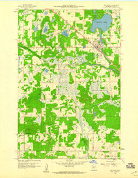
Other maps of this area

1919 · Leader
USGS Topo · 1:62,500

1953 · Brainerd
USGS Topo · 1:250,000

1957 · Brainerd
USGS Topo · 1:250,000

1958 · Brainerd
USGS Topo · 1:250,000

1959 · Nisswa
USGS Topo · 1:24,000

1959 · Pine River
USGS Topo · 1:24,000

1959 · Jenkins
USGS Topo · 1:24,000

1959 · Pine River SW
USGS Topo · 1:24,000

1965 · Brainerd
USGS Topo · 1:250,000

1970 · Backus
USGS Topo · 1:24,000