
1970 Map of Backus
USGS Topo · Published 1972About this map
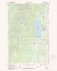
Pine Mountain Lake dominates the central landscape of this Cass County region, its eastern shore serving as the anchor for the town of Backus. This early 1970s survey illustrates a community deeply integrated with its surrounding woods and waters, where the Burlington Northern railroad corridor runs parallel to the lakefront, passing the Backus Municipal Airport and the Evergreen Cem. The western half of the map is defined by the dense wetlands and rolling terrain of the Deerfield State Forest, a wilderness area dotted with smaller water bodies like Lee Lake, Deer Lake, and Long Lake. This area was overseen from the Pine Mountain Lookout Tower, which provided a critical vantage point over the forest canopy. To the south, the landscape shifts toward the Pine River and the marshes of Bull Moose, showing the transition from managed forest to the riparian systems that feed the northern lakes.
Find a feature on this map
42 named features on this map. Tap any name to fly to it.
Don’t see what you’re looking for? This feature index may not catch every label — zoom into the map to look around manually.
Map Details
Editions of this 1970 Backus Map
2 editions found
Other maps of this area

1919 · Leader
USGS Topo · 1:62,500

1953 · Brainerd
USGS Topo · 1:250,000

1957 · Brainerd
USGS Topo · 1:250,000

1958 · Brainerd
USGS Topo · 1:250,000

1959 · Pine River
USGS Topo · 1:24,000

1965 · Brainerd
USGS Topo · 1:250,000

1970 · Spider Lake
USGS Topo · 1:24,000

1970 · Hackensack
USGS Topo · 1:24,000
1970 · Bungo Creek
USGS Topo · 1:24,000
1970 · Mildred
USGS Topo · 1:24,000