
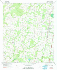
1971 Map of Pinehurst
USGS Topo · Published 1975About this map
Agricultural Dooly County is defined here by its network of rural congregations and family cemeteries situated along the tributaries of the Flint River system. The landscape transition is evident between the clustered settlement of Pinehurst along the Southern railway and the smaller hamlet of Lilly to the southwest. Land use is predominantly rural, with numerous unnamed field lines and a landing strip indicating the importance of aerial crop dusting to the local economy. Religious and community life centers on historic sites like Forest Chapel, Red Hill Ch, and Old Mt Zion Ch. The drainage patterns of Little Pennahatchee Creek and Sandy Mount Creek carve through the terrain, which is dotted with long-established burial grounds such as Evergreen Cem and Rock Spring Cem, providing essential landmarks for genealogists and local historians.
Find a feature on this map
26 named features on this map. Tap any name to fly to it.
Don’t see what you’re looking for? This feature index may not catch every label — zoom into the map to look around manually.
Map Details
Editions of this 1971 Pinehurst Map
2 editions found
Other maps of this area

1956 · Perry
USGS Topo · 1:62,500

1957 · Macon
USGS Topo · 1:250,000

1958 · Macon
USGS Topo · 1:250,000

1964 · Macon
USGS Topo · 1:250,000

1971 · Pineview NW
USGS Topo · 1:24,000

1971 · Pineview SW
USGS Topo · 1:24,000

1971 · Henderson
USGS Topo · 1:24,000

1972 · Byromville
USGS Topo · 1:24,000

1972 · Drayton
USGS Topo · 1:24,000
1972 · Marshallville SW
USGS Topo · 1:24,000