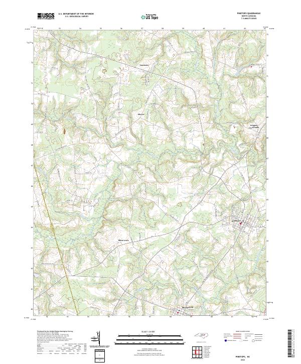
2022 Map of Pinetops
USGS Topo · Published 2022About this map
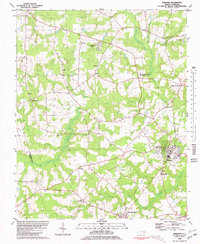
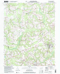
The town of Pinetops serves as the focal point for this landscape in the southeastern corner of the county, where a dense grid of streets like Arbor Ln and N 4th St meets the surrounding agricultural flatlands. To the southwest, the smaller settlement of Macclesfield is positioned near the winding course of Bynums Mill Run, indicating the historical importance of these watercourses for early industry. The terrain is defined by a network of slow-moving coastal plain streams, including Town Creek and the marshy expanses of Coker Swamp.
Find a feature on this map
87 named features on this map. Tap any name to fly to it.
Don’t see what you’re looking for? This feature index may not catch every label — zoom into the map to look around manually.
Map Details
Editions of this 2022 Pinetops Map
This is the sole edition of this map. No revisions or reprints were ever made.
Historical Maps of Fox Hollow Through Time
3 maps found