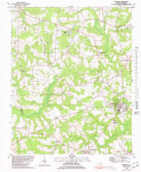
1980 Map of Pinetops
USGS Topo · Published 1981About this map
Temperance Hall stands as a significant landmark in the western portion of this 1980 survey, marking a landscape defined by the agricultural and educational hubs of Edgecombe County. The map details the growing community of Pinetops, where residential expansion is visible near the South Edgecombe Jr High Sch. Further south, the town of Macclesfield is situated along the Railroad, illustrating the importance of rail transit to these small rural centers. The terrain is characterized by intricate drainage systems like Cokey Swamp and Beaverdam Swamp, which dictate the placement of roads and farmsteads.
Find a feature on this map
36 named features on this map. Tap any name to fly to it.
Don’t see what you’re looking for? This feature index may not catch every label — zoom into the map to look around manually.
Map Details
Editions of this 1980 Pinetops Map
This is the sole edition of this map. No revisions or reprints were ever made.
Other maps of this area

1902 · Rocky Mount
USGS Topo · 1:62,500

1902 · Tarboro
USGS Topo · 1:62,500

1903 · Tarboro
USGS Topo · 1:62,500

1904 · Falkland
USGS Topo · 1:62,500

1904 · Rocky Mount
USGS Topo · 1:62,500

1904 · Wilson
USGS Topo · 1:62,500

1953 · Rocky Mount
USGS Topo · 1:250,000

1954 · Rocky Mount
USGS Topo · 1:250,000
1975 · Rocky Mount
USGS Topo · 1:24,000
1977 · Rocky Mount
USGS Topo · 1:24,000