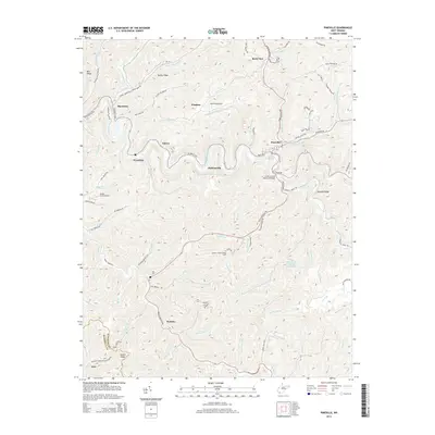
2014 Map of Pineville
USGS Topo · Published 2014About this map
The Guyandotte River snakes through the heart of this Wyoming County landscape, carving deep valleys that define the settlement patterns around Pineville. In the early 21st century, the region's infrastructure reflects a mix of traditional coal-country hubs and modern connectivity, with the R D Bailey Hwy and the Appalachian Hwy intersecting near the county seat. The topography is dominated by high points like Lambert Knob Lookout Tower and Micajah Ridge, which overlook a network of hollows and creeks such as Indian Creek and Skin Fork. Smaller communities like Marianna, Glover, and Wyoming are concentrated along the riverbanks, while specialized transportation sites like Kee Field Airport and Swope Farm Airport occupy the limited level ground atop the ridges. This survey also documents local industrial access, including a Private Mining Rd and the numerous small branches feeding the primary river system.
Find a feature on this map
90 named features on this map. Tap any name to fly to it.
Don’t see what you’re looking for? This feature index may not catch every label — zoom into the map to look around manually.
Map Details
Editions of this 2014 Pineville Map
This is the sole edition of this map. No revisions or reprints were ever made.
Other maps of this area

1887 · Pocahontas
USGS Topo · 1:125,000

1891 · Tazewell
USGS Topo · 1:125,000

1891 · Pocahontas
USGS Topo · 1:125,000

1891 · Oceana
USGS Topo · 1:125,000

1891 · Raleigh
USGS Topo · 1:125,000

1893 · Oceana
USGS Topo · 1:125,000

1894 · Pocahontas
USGS Topo · 1:125,000

1895 · Tazewell
USGS Topo · 1:125,000

1895 · Pocahontas
USGS Topo · 1:125,000

1897 · Tazewell
USGS Topo · 1:125,000