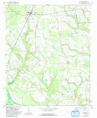
1980 Map of Pinewood
USGS Topo · Published 1992About this map
Pinewood and the neighboring settlements of Rimini and Panola sit along the border of Sumter and Clarendon Counties, defined by a complex network of wetlands and hydraulic history. The Coast Line Seaboard railroad serves as the primary corridor through the western portion of the map, cutting past the Manchester State Forest toward the banks of Lake Marion. This 1980s landscape is characterized by its numerous small congregational centers and community landmarks, including St Peters Ch, New Branch Ch, and Mt Pleasant Ch. Water management is central to the area’s layout, evidenced by the large Elliott Millpond and the slow-moving reaches of Boggy Swamp and Summy Swamp. These features illustrate a rural economy transitioning from traditional milling and rail transport to modern conservation and land management.
Find a feature on this map
37 named features on this map. Tap any name to fly to it.
Don’t see what you’re looking for? This feature index may not catch every label — zoom into the map to look around manually.
Map Details
Editions of this 1980 Pinewood Map
2 editions found
Other maps of this area

1943 · Eastover
USGS Topo · 1:62,500

1946 · Elloree
USGS Topo · 1:62,500

1946 · Sumter
USGS Topo · 1:62,500

1953 · Poinsett State Park
USGS Topo · 1:24,000

1954 · Augusta
USGS Topo · 1:250,000

1957 · Sumter
USGS Topo · 1:62,500

1957 · Augusta
USGS Topo · 1:250,000

1958 · Augusta
USGS Topo · 1:250,000

1961 · Augusta
USGS Topo · 1:250,000

1962 · Augusta
USGS Topo · 1:250,000