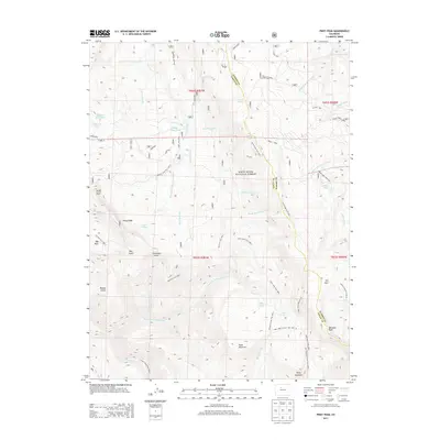
2013 Map of Piney Peak
USGS Topo · Published 2013About this map
The high-country divide between Eagle and Summit counties dominates this 2013 survey, anchored by the prominent summit of Piney Peak. This high-altitude landscape within the White River National Forest is defined by a dense network of hydrologic features and steep topographic changes. Notable water bodies such as Blue Lake, Mahan Lake, and the marshy Slough Grass Lake are dispersed across the ridges. A complex trail system, including the Elliot Ridge Trail and Soda Lakes Trail, provides the primary means of navigating the backcountry. Geologic and natural landmarks like Chimney Rock and Mather Spring offer specific points of interest for those studying the area's physical geography. The drainage patterns are clearly defined by Sheephorn Creek and the North Fork Piney River, illustrating how snowmelt feeds the lower valleys from peaks like Meridian Peak.
Find a feature on this map
59 named features on this map. Tap any name to fly to it.
Don’t see what you’re looking for? This feature index may not catch every label — zoom into the map to look around manually.
Map Details
Editions of this 2013 Piney Peak Map
This is the sole edition of this map. No revisions or reprints were ever made.
Other maps of this area

1933 · Mt. Powell
USGS Topo · 1:48,000

1934 · Minturn
USGS Topo · 1:62,500

1940 · Mount Powell
USGS Topo · 1:62,500

1950 · Minturn
USGS Topo · 1:62,500

1957 · Leadville
USGS Topo · 1:250,000

1959 · Leadville
USGS Topo · 1:250,000

1960 · Leadville
USGS Topo · 1:250,000

1962 · Leadville
USGS Topo · 1:250,000

1962 · Edwards
USGS Topo · 1:24,000

1964 · Leadville
USGS Topo · 1:250,000