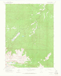
1962 Map of Pingree Park
USGS Topo · Published 1964About this map
Colorado State University (Pingree Park Campus) serves as a central hub for this high-altitude landscape in Larimer County, where the borders of Roosevelt National Forest and Rocky Mountain National Park meet. The 1962 survey reveals a terrain defined by private holdings like Koenig Ranch and Sky Ranch tucked among prominent peaks. A sophisticated network of trails, including the Mummy Pass Trail and Bulwark Ridge Trail, provides access to the high backcountry of the Stormy Peaks and Signal Mountain. The map records specific recreational and industrial points of interest, such as the Tom Bennett Campground and the White Rock Quarry near the Cache la Poudre River. To the south, the headwaters of the Big Thompson River are fed by glacial lakes including Lake Louise and Lake Husted.
Find a feature on this map
44 named features on this map. Tap any name to fly to it.
Don’t see what you’re looking for? This feature index may not catch every label — zoom into the map to look around manually.
Map Details
Editions of this 1962 Pingree Park Map
4 editions found
Other maps of this area

1905 · Mount Olympus
USGS Topo · 1:62,500

1907 · Mount Olympus
USGS Topo · 1:62,500

1907 · Livermore
USGS Topo · 1:125,000

1909 · Livermore
USGS Topo · 1:125,000

1915 · Longs Peak
USGS Topo · 1:125,000

1916 · Home
USGS Topo · 1:125,000

1919 · Rocky Mountain National Park
USGS Topo · 1:125,000

1920 · Home
USGS Topo · 1:125,000

1954 · Greeley
USGS Topo · 1:250,000

1957 · Greeley
USGS Topo · 1:250,000