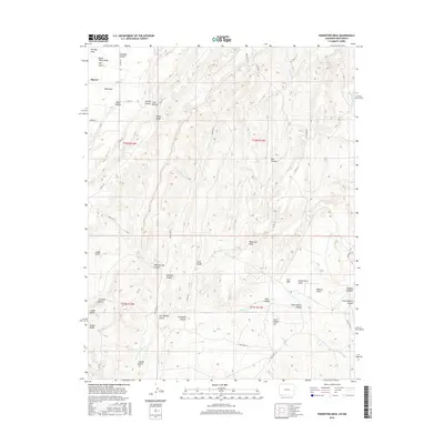
2016 Map of Pinkerton Mesa
USGS Topo · Published 2016About this map
The settlement of Marvel stands as the primary community in this arid, high-elevation landscape along the Colorado and New Mexico border. Named for its local topography, Pinkerton Mesa dominates the central terrain, which is deeply carved by a network of drainage features like McDermott Arroyo and Soda Springs Canyon. The region's geological character is defined by prominent volcanic and erosional features, including Cinder Butte, N Cinder Butte, and the Cinder Bluffs to the southwest. Land use is largely defined by the township and range survey system, visible through the grid of rural routes such as Co RD 131 and Indian Rte 114. Evidence of the area's human history is preserved in family-named landmarks such as Orrie Walker Flat and Clyde Walker Canyon, which suggest a legacy of ranching and homesteading in this corner of San Juan County.
Find a feature on this map
47 named features on this map. Tap any name to fly to it.
Don’t see what you’re looking for? This feature index may not catch every label — zoom into the map to look around manually.
Map Details
Editions of this 2016 Pinkerton Mesa Map
This is the sole edition of this map. No revisions or reprints were ever made.
Other maps of this area

1889 · Largo
USGS Topo · 1:250,000

1889 · Chaco
USGS Topo · 1:250,000

1892 · Chaco
USGS Topo · 1:250,000

1895 · Largo
USGS Topo · 1:250,000

1908 · Ignacio
USGS Topo · 1:125,000

1913 · Red Mesa
USGS Topo · 1:62,500

1924 · Ignacio
USGS Topo · 1:125,000

1945 · Durango
USGS Topo · 1:250,000

1953 · Durango
USGS Topo · 1:250,000

1954 · Durango
USGS Topo · 1:250,000