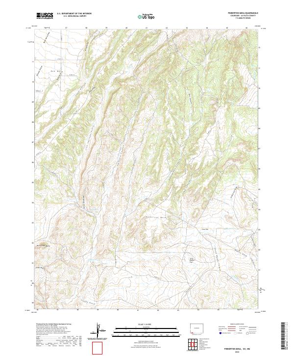
2022 Map of Pinkerton Mesa
USGS Topo · Published 2022About this map
Pinkerton Mesa anchors this high-desert landscape in La Plata County, where a complex network of seasonal drainages and named canyons defines the terrain. The presence of Soda Springs within Soda Springs Canyon indicates a vital historical water source for the region's inhabitants and livestock. To the south, topographic prominence is found at North Cinder Butte and the Cinder Bluffs, while flatlands like Orrie Walker Flat and Cow Flat suggest areas suitable for grazing or early settlement. Named landmarks such as Clyde Walker Canyon and Price Walters Canyon provide genealogical clues to the families who established themselves in this arid corner of Colorado. Transportation is primarily facilitated by primitive routes and county roads, including Co RD 138 and the extensive Indian Rte 111, which navigate through features like Long Hollow and Valencia Canyon.
Find a feature on this map
42 named features on this map. Tap any name to fly to it.
Don’t see what you’re looking for? This feature index may not catch every label — zoom into the map to look around manually.
Map Details
Editions of this 2022 Pinkerton Mesa Map
This is the sole edition of this map. No revisions or reprints were ever made.
Other maps of this area

1889 · Largo
USGS Topo · 1:250,000

1889 · Chaco
USGS Topo · 1:250,000

1892 · Chaco
USGS Topo · 1:250,000

1895 · Largo
USGS Topo · 1:250,000

1908 · Ignacio
USGS Topo · 1:125,000

1913 · Red Mesa
USGS Topo · 1:62,500

1924 · Ignacio
USGS Topo · 1:125,000

1945 · Durango
USGS Topo · 1:250,000

1953 · Durango
USGS Topo · 1:250,000

1954 · Durango
USGS Topo · 1:250,000