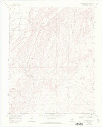
1968 Map of Pinkerton Mesa
USGS Topo · Published 1972About this map
Pinkerton Mesa dominates this 1968 study of the Southern Ute Indian Reservation, where the landscape is defined by an intricate network of desert drainage systems and rising gas and oil production. The terrain is marked by distinctive features such as North Cinder Butte and the broad expanses of Orrie Walker Flat and Cow Flat. Numerous extraction points, labeled as Gas Well and Oil Well, dot the various canyons and mesas, signaling the mid-century industrial utility of this arid region. The map captures a complex system of named gulches and canyons, including Iron Springs Gulch, Fortyfour Canyon, and Valencia Canyon, which carve through the high ground. These natural pathways, alongside landmarks like the Pumping Sta, reflect the convergence of historical topography and modern resource management across the Colorado-New Mexico borderlands.
Find a feature on this map
34 named features on this map. Tap any name to fly to it.
Don’t see what you’re looking for? This feature index may not catch every label — zoom into the map to look around manually.
Map Details
Editions of this 1968 Pinkerton Mesa Map
This is the sole edition of this map. No revisions or reprints were ever made.
Other maps of this area

1889 · Largo
USGS Topo · 1:250,000

1889 · Chaco
USGS Topo · 1:250,000

1892 · Chaco
USGS Topo · 1:250,000

1895 · Largo
USGS Topo · 1:250,000

1908 · Ignacio
USGS Topo · 1:125,000

1913 · Red Mesa
USGS Topo · 1:62,500

1924 · Ignacio
USGS Topo · 1:125,000

1945 · Durango
USGS Topo · 1:250,000

1953 · Durango
USGS Topo · 1:250,000

1954 · Durango
USGS Topo · 1:250,000