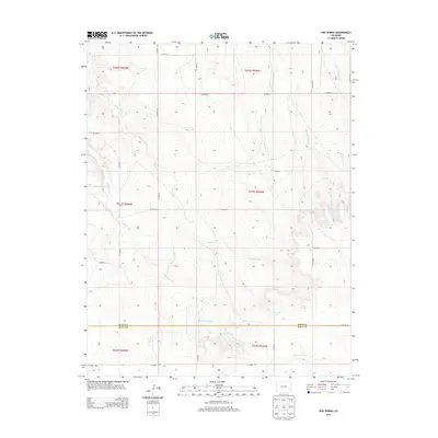
2013 Map of Pipe Spring
USGS Topo · Published 2013About this map
Pipe Spring and Thompson Spring mark vital water points in this high-plains landscape along the border of Bent and Baca Counties. The drainage patterns of Shelton Creek and Caddoa Creek define the local topography, showing how seasonal water courses have carved the terrain. The map captures a transition of land use where a grid of rural county roads, such as CO Road G and CO Road WW, provides the only modern infrastructure through the vast rangeland. Local nomenclature like Little Angry Creek and Mouth Waters suggests the character of these intermittent streams, which were crucial to the early ranching operations of southeastern Colorado. This survey illustrates the persistent isolation of the region, where named springs and creeks remain the primary landmarks across the township and range system.
Find a feature on this map
17 named features on this map. Tap any name to fly to it.
Don’t see what you’re looking for? This feature index may not catch every label — zoom into the map to look around manually.
Map Details
Editions of this 2013 Pipe Spring Map
This is the sole edition of this map. No revisions or reprints were ever made.
Other maps of this area

1891 · Higbee
USGS Topo · 1:125,000

1892 · Two Butte
USGS Topo · 1:125,000

1893 · Higbee
USGS Topo · 1:125,000

1893 · Two Butte
USGS Topo · 1:125,000

1955 · La Junta
USGS Topo · 1:250,000

1958 · La Junta
USGS Topo · 1:250,000

1966 · Toonerville SE
USGS Topo · 1:24,000

1967 · Hand Springs
USGS Topo · 1:24,000

1968 · La Junta
USGS Topo · 1:250,000
1968 · Dripping Spring
USGS Topo · 1:24,000