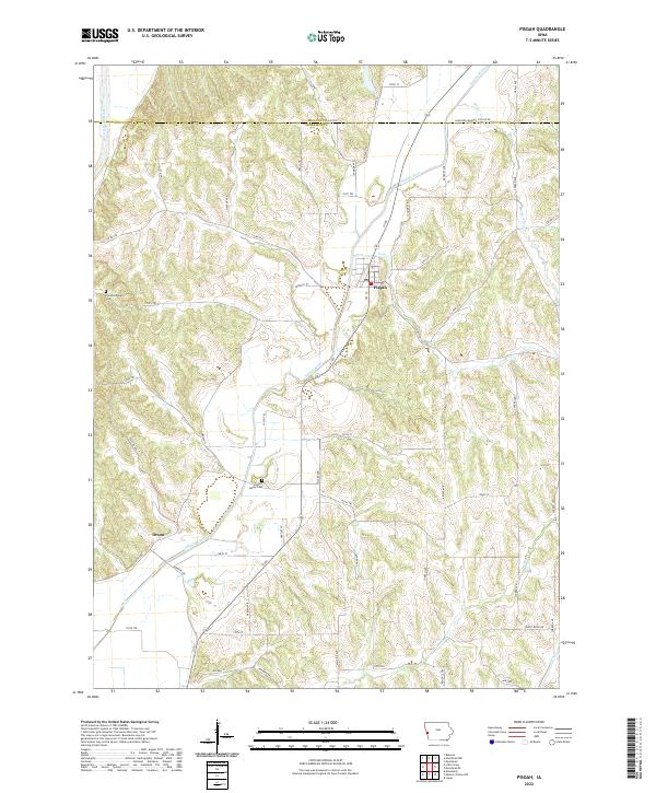
2022 Map of Pisgah
USGS Topo · Published 2022About this map
Pisgah serves as the primary hub in this western Iowa landscape, where the Soldier River carves a significant valley through the loess hills of Harrison and Monona counties. This modern survey illustrates the enduring rural structure of the region, anchored by the smaller settlement of Orson to the southwest. The terrain is defined by a dense network of ridges and drainage systems, with Stowe Cr, Cobb Cr, and Steer Cr feeding into the larger river valley. For those researching local history or genealogy, the map identifies key burial sites including Soldier Valley Cem and Fountainbleau Cem. The rectilinear grid of county roads, such as Co HWY e60 and Ia 183, follows the section lines across the dissected uplands, showing how the 21st-century infrastructure remains tied to the original Public Land Survey System township boundaries.
Find a feature on this map
67 named features on this map. Tap any name to fly to it.
Don’t see what you’re looking for? This feature index may not catch every label — zoom into the map to look around manually.
Map Details
Editions of this 2022 Pisgah Map
This is the sole edition of this map. No revisions or reprints were ever made.
Other maps of this area

1954 · Omaha
USGS Topo · 1:250,000

1955 · Fremont
USGS Topo · 1:250,000

1957 · Fremont
USGS Topo · 1:250,000

1957 · Omaha
USGS Topo · 1:250,000

1958 · Omaha
USGS Topo · 1:250,000

1958 · Fremont
USGS Topo · 1:250,000

1970 · Little Sioux
USGS Topo · 1:24,000
1970 · Blencoe
USGS Topo · 1:24,000

1970 · Logan
USGS Topo · 1:24,000

1970 · Mondamin
USGS Topo · 1:24,000